¡Buenos dias! Light and variable winds were again detected over the southern Sea of Cortez by satellite passes last evening, and all model forecasts show light background flow will continue today. Model forecasts and in good agreement that the surface pressure pattern will tighten over BCS on Sunday, and with sunny skies expected, we will likely see a good thermal boost as well. The background flow will fall to marginal levels on Monday, and at this point it looks like it will be just below the level needed to fully activate our local wind machine. Tuesday will likely be a light wind day as the surface pressure gradient is forecast to be very weak, with only light onshore breezes expected. A return to windy afternoons is likely on Wenesday and Thursday as surface high pressure builds into BCS from the eastern Pacific. Long-range models disagree, but some are showing just enough background flow lasting into Friday to give us another windy afternoon.
- Today…Sunny. Northeast wind 10-12 mph.
- Sunday…Sunny. North wind 16-20 mph.
- Monday…Sunny. North wind 14-16 mph.
- Tuesday…Sunny. Northeast wind 10-12 mph.
- Wednesday…Sunny. North wind 16-20 mph.
- Thursday…Sunny. North wind 18-22 mph.
- Friday…Sunny. North wind 16-18 mph.
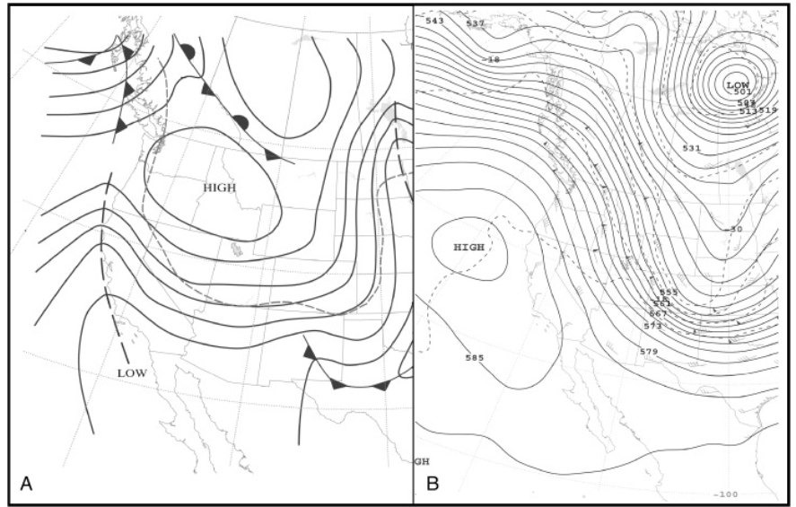
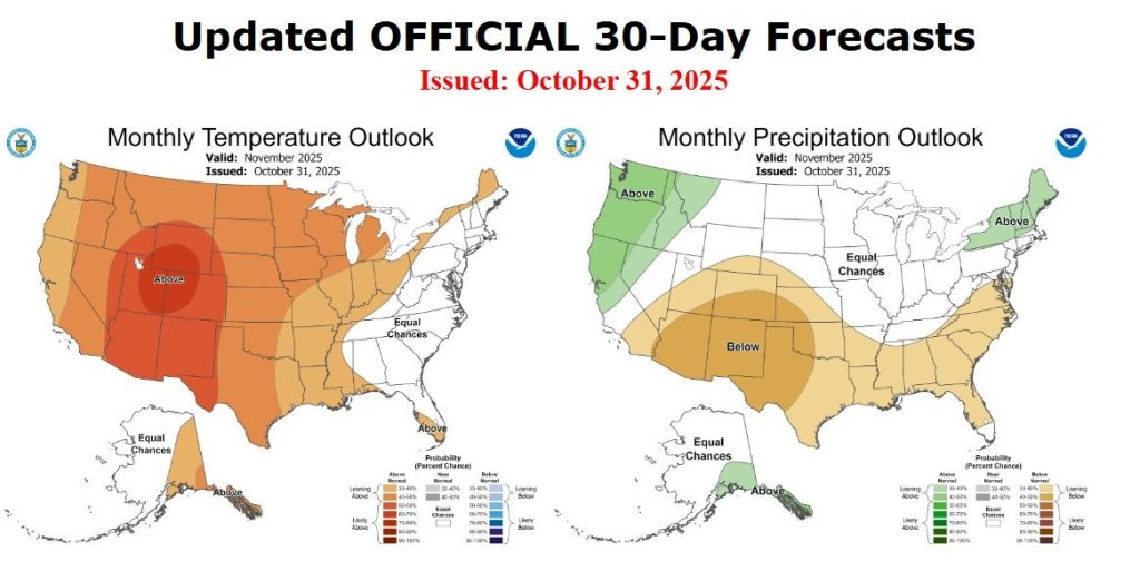
Nerd Note: The U.S. Climate Prediction Center (part of NOAA) just issued its outlook for temperature and precipitation for November, and it shows a continuation of warm and dry conditions for the interior west of the U.S. For us this likely means above normal temperatues and fewer strong nortes as a ridge of high pressure in the middle levels of the atmosphere over the interior west of the U.S. will keep strong surface high pressure systems from descending into the interior west from Canada. The image below shows typical conditions for a developing norte, with a strong mid-level ridge of high pressure along the west coast and strong mid-level trough inland (B). This usually leads to a strong surface high over the interior west of the U.S., with a tight surface pressure gradient over BCS as the surface high builds into the 4-corners region (A). The Climate Prediction Center forecast for November (derived from their text discussion) indicates the opposite mid-level pattern, with a trough of low pressure off the west coast and a ridge of high pressure inland over the interior west.