¡Buenos dias! Yesterday was one of those days where northern beaches saw winds peaking around 16 mph, while southern beaches only hovered around 12 mph. It looks like light winds will be the rule at all area beaches today, as a late evening pass by the Oceansat satellite measured light and variable winds across the southern Sea of Cortez, and all of the most recent numerical model forecasts show light background flow continuing today. Surface high pressure over the eastern Pacific will strengthen and build eastward into the Baja Peninsula on Wednesday, and this will bring increasing NW flow to BCS. While model forecasts do show some west component to the background wind, sunny skies should help trigger a substantial local thermal to help pull the flow onshore. Winds may increase a bit on Thursday, and with only a few thin, high clouds expected, we should see another good thermal boost as well. Friday looks to be a marginal day at this point as models generally agree that the surface pressure gradient will weaken substantially over our area. Long-range model forecasts are in fairly good agreement that some north flow will return on Sunday and last at least through next Monday.
- Today…Sunny. Northeast wind 10-12 mph.
- Wednesday…Sunny. North wind 16-20 mph.
- Thursday…Mostly sunny. North wind 18-22 mph.
- Friday…Sunny. North wind 12-14 mph.
- Saturday…Sunny. Northeast wind 10-12 mph.
- Sunday…Sunny. North wind 16-20 mph.
- Monday…Sunny. North wind 16-18 mph.
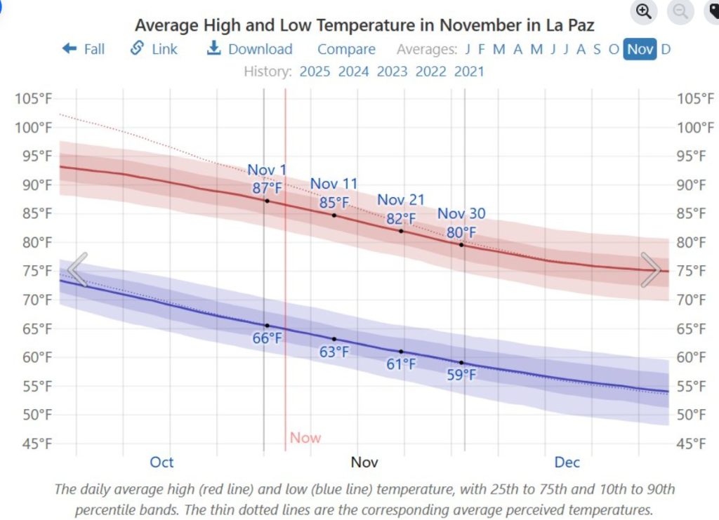
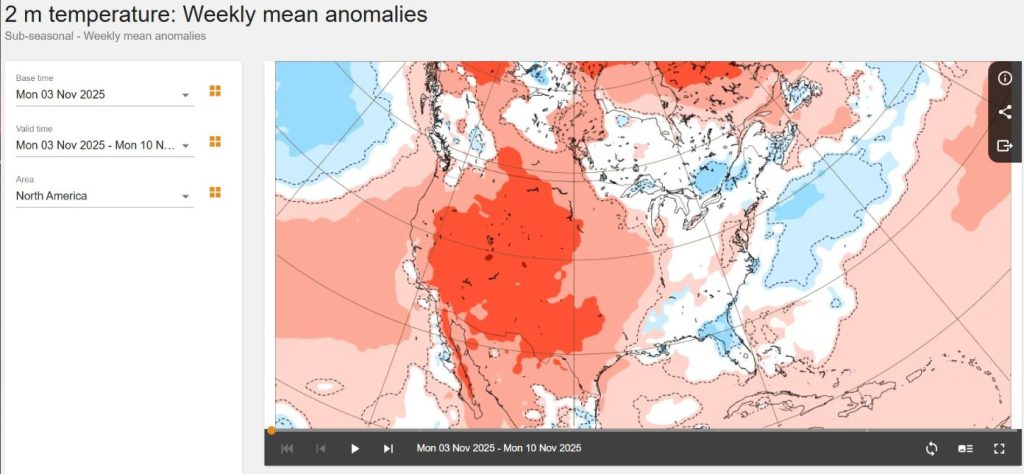
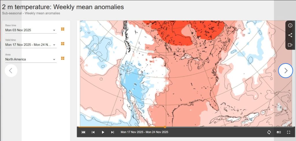
Nerd Note: As we move into November, we normally see temperatures begin to cool substantially (see graph of average temperatures in La Paz from Weatherspark). This year several weather stations in La Paz have continued to record high temperatures of 90-95F over the past couple of weeks, and even here in La Ventana yesterday’s high hovered around 90F. Long-range forecasts from the European Center for Medium Range Forecasting (ECMWF) are showing we will likely continue to see abnormally warm temperatures over the next week or so, however a pattern change in the middle levels of the atmosphere may bring us much cooler weather around November 15 (see graphs below).