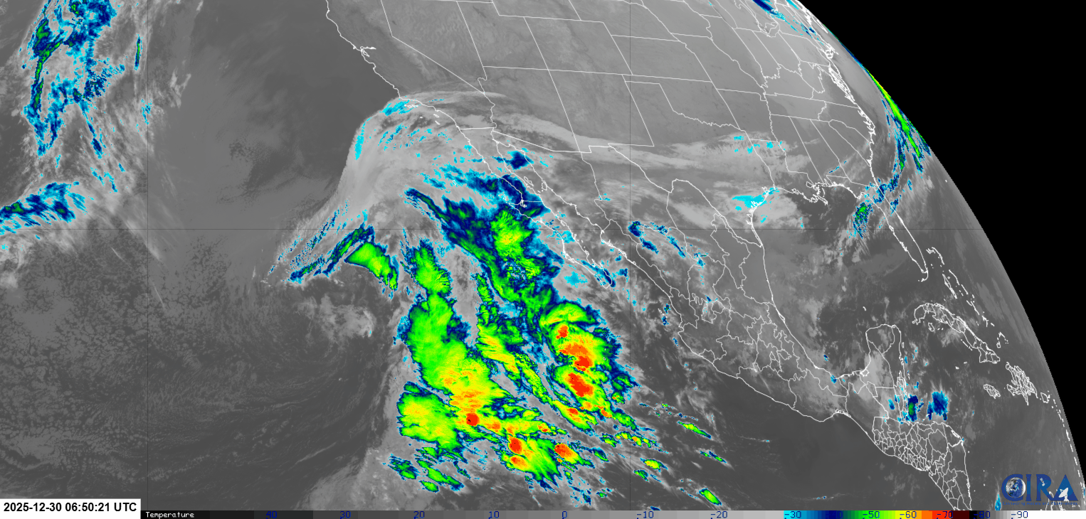
¡Buenos dias! An Oceansat satellite pass late last evening measured solid 15 knot NNW winds near Cerralvo, with 20 knot winds not far from the northern tip of the island. Farther north, a full-blown norte was howling, with 30 knot winds measured just east of Loreto. Model forecasts are in good agreement that winds will subside a bit today, but ample north background flow will continue…normally more than enough to fully trigger our local wind machine. The wild-card for today will be the amount of high cloud cover. Satellite loops from early this morning showed a very large area of low pressure to our west, with a huge area of cloud cover being drawn north…northeastward towards BCS (see below). Models are in good agreement that while high clouds will move into our area today, they may be thin enough through much of the day to allow some filtered sun to at least partially trigger our local thermal. As the low moves northward on Wednesday, thick cloud cover should essentially extiguish our thermal, so only light winds are expected. The low is forecast to move onshore in southern California on Thursday, with the bulk of the clouds over BCS moving off to the east. Surface high pressure centered near the 4-corners region of the U.S. will remain nearly stationary through at least next Monday and provide solid north background flow. With only some thin, high clouds expected Friday through Monday, we should see good thermal boosts each day.
(Tides)
- Today…Partly sunny. North wind 16-18 mph.
- Wednesday…Cloudy with a few sprinkles possible. Northeast wind 10-12 mph.
- Thursday…Mostly sunny. North wind 16-18 mph.
- Friday…Mostly sunny. North wind 18-22 mph.
- Saturday…Mostly sunny. North wind 18-22 mph.
- Sunday…Sunny. North wind 18-22 mph.
- Monday…Mostly sunny. North wind 18-22 mph.