¡Buenos dias! An Oceansat satellite pass last evening measured light and variable winds over the Sea of Cortez near Cerralvo, and model forecasts are in agreement that only light onshore breezes will be the rule this afternoon. Satellite loops early this morning showed a large mid-level low pressure system centered west of the northern Baja Peninsula, and model forecasts indicate that this system will move over the Baja Peninsula on Saturday. As it does our background flow will become westerly and we will likely see some scattered showers (see nerd note below). The low will continue eastward on Sunday and surface high pressure will rapidly build to our north and send a fresh pulse of north flow down the Sea of Cortez. With sunny skies returning on Sunday, we will see a good thermal boost as well. Medium to long-range model forecasts are in excellent agreement that the surface high to our north will remain nearly stationary, with solid north background flow continuing into Thursday. There will be periods of high clouds from Monday through Thursday, but at this point it looks like there will be enough thin spots in the cloud cover to allow filtered sunshine to give us a significant thermal bump each afternoon.
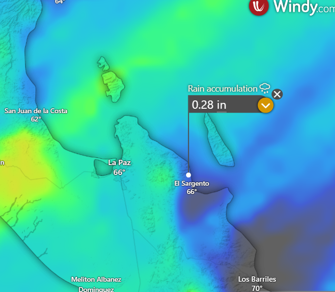
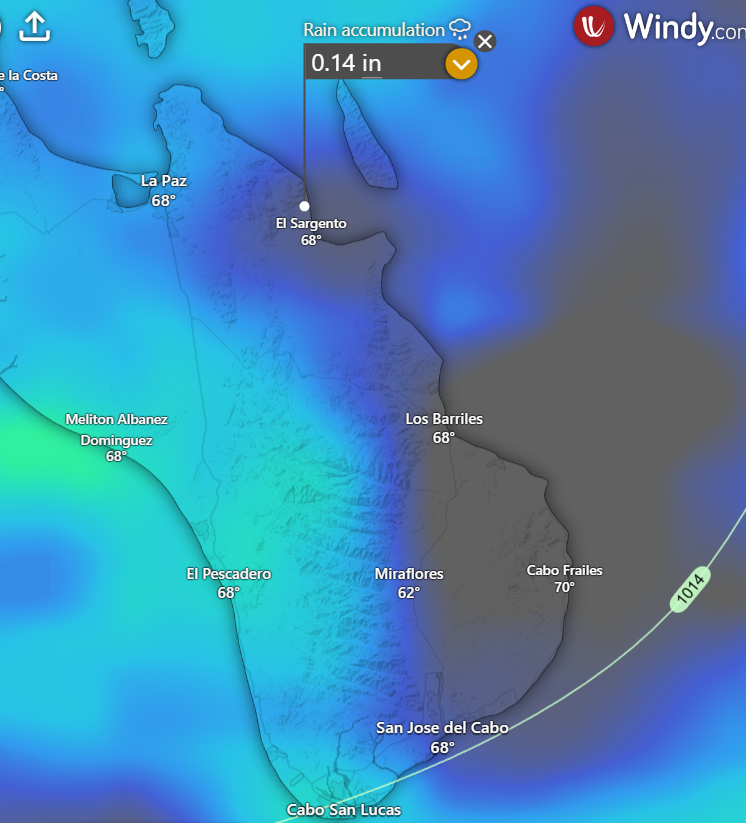
Nerd Note: While all of the latest model guidance does show scattered to numerous showers will move across our region on Saturday, several of the models are hinting at a rain-shadowing effect on the east side of the Cacachilas and Sierra de la Laguna mountains. This seems likely as the circulation around the strong mid-level low to our north will create moderate to strong west winds aloft, and that should focus most of the rain to the west of La Ventana as air is forced up and over the mountains. As the air then sinks to the east of the mountains, it will tend to dry out and likely limit the amount of rainfall we see. The graphics below show the rainfall forecast from a couple of the models. Note the significantly reduced amounts of rain to the east of the mountains, from La Ventana to Los Bariles and the East Cape.
- Today…Mostly cloudy with a few showers possible late. Northeast wind 8-10 mph.
- Saturday…Mosltly cloudy with showers likely. Southwest to west wind 5-10 mph.
- Sunday…Sunny. North wind 16-20 mph.
- Monday…Mostly sunny. North wind 20-24 mph.
- Tuesday…Mostly sunny. North wind 18-22 mph.
- Wednesday…Mostly sunny. North wind 18-22 mph.
- Thursday…Mostly sunny. North wind 18-22 mph.