Wind – January 29, 2026

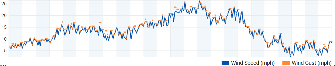
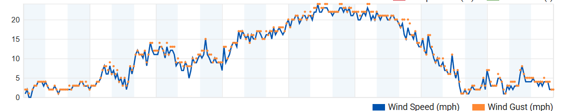
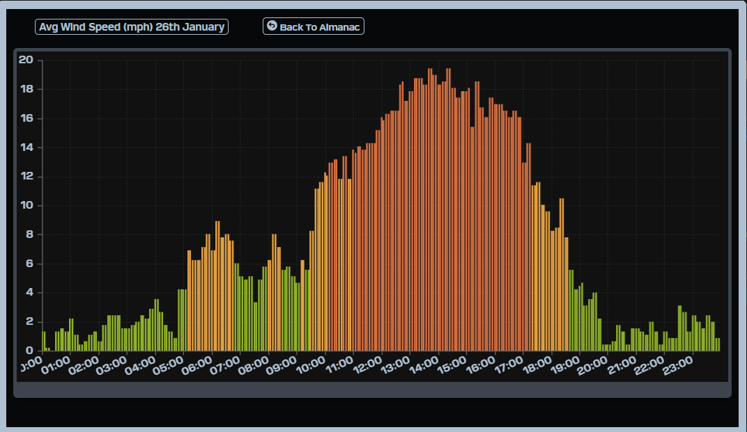
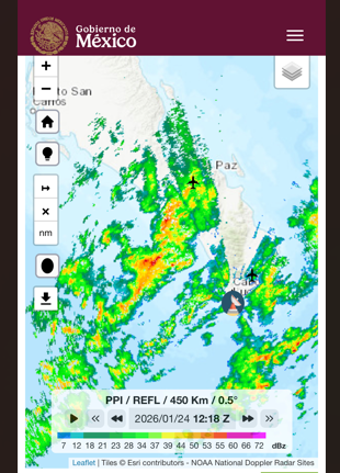
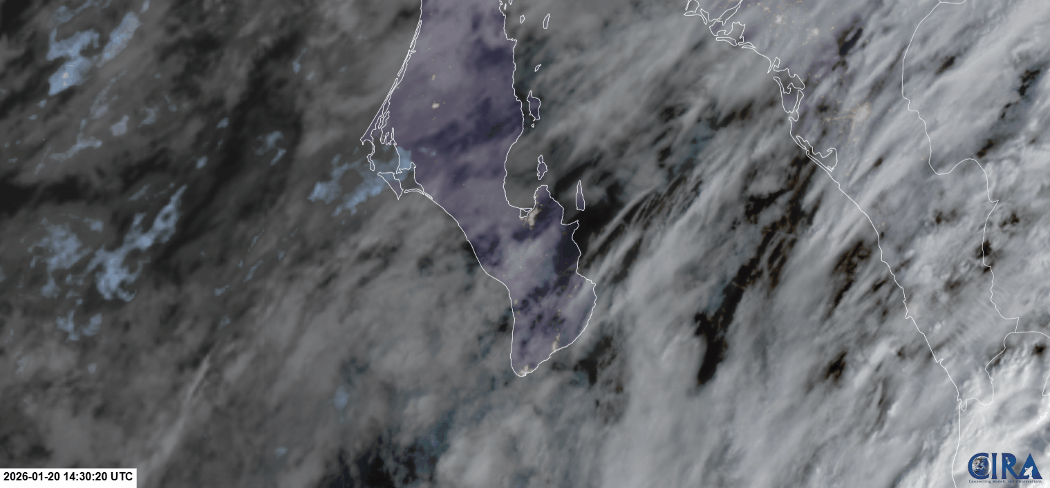
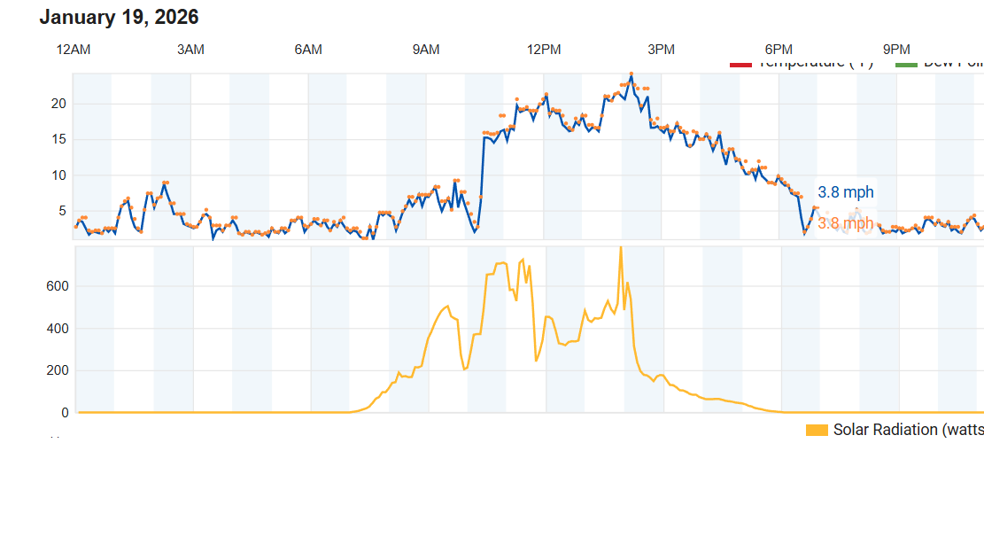
¡Buenos dias! An Oceansat satellite pass around midnight measured solid 15 knot NNW winds over the southern Sea of Cortez, and model forecasts show similar background flow will continue today as surface high pressure centered near Salt Lake City this morning remains parked over the interior west of the U.S. The big wild card for the next several days will continue to be the thickness of high cloud cover. For today, satellite loops show significant high clouds to our west were creeping eastward, but if we see any thinning of the cloud cover we will likely get just enough of a thermal boost to trigger our wind machine. Some of the models are hinting at this, so I'll be optimistic that we'll see another windy afternoon. Models are in good agreeent that the surface pressure gradient will tighten a bit on Friday, with the background flow increasing over our region. If we were expecting full sunshine, we would likely see low-end norte conditions tomorrow, but with high clouds persisting we should only see a modest uptick in the winds. There are indications of a significant west component for tomorrow, so winds will likely be gusty, especially on northern beaches. The surface high to our north is forecast to begin weakening on Saturday, but enough background flow and filtered sun should hang around to give us one more rideable day. Model forecasts are in good agreement that the pressure gradient will be weak on Sunday and Monday, so only light winds are expected. Extended range forecasts suggest a return on relatively light north background flow on Tuesday, with slowly increasing NNW flow on Wednesday as surface high pressure again builds back into the interior west of the U.S.

(Tides)
  • Today…Partly sunny. North wind 16-20 mph.
  • Friday…Partly sunny. North wind 18-22 mph and gusty.
  • Saturday…Partly sunny. North wind 16-18 mph.
  • Sunday…Partly sunny. North wind 10-12 mph.
  • Monday…Sunny. Northeast wind 12-14 mph.
  • Tuesday…Mostly sunny. Northeast wind 14-16 mph.
  • Wednesday…Sunny. North wind 16-18 mph.

Wind – January 28, 2026

¡Buenos dias! We saw a very fortunate early afternoon thinning of the high cloud cover yesterday, and the wind gauge at the campground showed a solid afternoon with winds ranging from 18-21 mph from 1 pm until just past 4:30. A satellite pass overnight measured NNW winds of 15 knots over the southern Sea of Cortez, and models are again in good agreement that similar background wind will continue today. Infrared satellite loops early this morning continued to show a large swath of high clouds from BCS westward into the Pacific for over 1200 miles, and as was the case yesterday, the thickness of high clouds today will be a major factor in our winds this afternoon. At this point it looks like there again may be some thin spots in the cloud cover, so I'll be optimistic that we see another windy afternoon. The remainder of the forecast looks on track as surface high pressure remains anchored to our north and high clouds continue to stream into our area through Friday. The surface high centered far to our north will weaken on Saturday into Sunday, and the background flow may fall just below the threshold to fully trigger our wind machine on Sunday. At this point it looks like Monday and Tuesday will be down days as the surface pressure gradient in our region remains weak.

(Tides)
  • Today…Partly sunny. North wind 16-20 mph.
  • Thursday…Partly sunny. North wind 16-20 mph.
  • Friday…Partly sunny. North wind 18-22 mph.
  • Saturday…Partly sunny. North wind 16-18 mph.
  • Sunday…Mostly sunny. North wind 12-14 mph.
  • Monday…Sunny. Northeast wind 10-12 mph.
  • Tuesday…Mostly sunny. Northeast wind 10-12 mph.

Wind – January 27, 2026

¡Buenos dias! Wind gauges at both Rasta Beach and the campground yesterday showed 10-minute average sustained winds peaked at around 20 mph (corrected for a 3-5 mph high bias in the Weather Underground platform) with gusts well into the mid 20s. There was a significant west component to the winds at Rasta, and the wind trace showed gusty conditions there…see nerd note below. An ASCAT satellite pass just before midnight measured 15-20 knot NNW winds near Cerralvo. The latest batch of model forecasts show the background flow decreasing a bit this afternoon, but ample north…northwest wind should persist through the day. As we discussed yesterday, the biggest variable this week will be the thickness of high cloud cover, and today is no exception. Infrared satellite loops early this morning showed thick high clouds over our region, but model forecasts are in good agreement that we will see at least some thinning of the high clouds this afternoon, with at least a partial thermal boost looking likely. Surface high pressure centered over western Colorado this morning will remain over the interior west of the U.S. for much of this week, with solid N to NNW background flow continuing through at least Friday. The surface high will begin to weaken on Saturday, then models are in good agreement that we’ll see the surface pressure gradient over BCS become very weak on Sunday into Monday, with only light onshore breezes expected then. We will continue a game of cat and mouse with the high clouds through Saturday, and I’ll likely have to tweek the wind speeds each day as we get a better picture of the short-term cloud cover…stay tuned.

Nerd Note: Verification of wind forecasts can be subjective, so I stick to one method. To verify the forecasts each day, I use a wind gauge at the campground and a display platform that uses the world standard of 10-minute sustained winds. I also look at wind traces from the company Weather Underground, which displays 5-minute sustained winds and gusts at multiple locations. The graphs below show the Weather Underground wind speeds yesterday at Rasta (top graph), the Weather Underground wind speeds at the campground (middle graph), and the wind speeds using the campground gauge but with a 10-minute average wind speed (bottom graph). Note the high bias of 3-4 mph in the Weather Underground campground trace versus the 10-minute average trace for the same location. I’ve noticed over the last several years that this is a very consistent feature. Also, note how the Weather Underground trace at Rasta yesterday was very jagged compared to the camground, indicating gustier conditions up north.

(Tides)

  • Today…Morning high clouds…then becoming partly sunny. North wind 16-20 mph.
  • Wednesday…Partly sunny. North wind 16-20 mph.
  • Thursday…Partly sunny. North wind 16-20 mph.
  • Friday…Partly sunny. North wind 18-22 mph.
  • Saturday…Partly sunny. North wind 16-18 mph.
  • Sunday…Sunny. Northeast wind 10-12 mph.
  • Monday…Sunny. Northeast wind 10-12 mph.

Wind – January 26, 2026

¡Buenos dias! North…northwest background flow increased last night as an ASCAT satellite pass before midnight showed 15 knot winds were common over the southern Sea of Cortez. Model forecasts are in excellent agreement that surface high pressure centered over western Colorado this morning will build into the 4-corners region of the U.S. today then remain essentially stationary through Friday with solid north…northwest flow through the period. A couple of the models are hinting at some wind-shadowing on northern beaches today, so conditions may be gusty there. The surface pressure gradient should begin to weaken a bit next Saturday, then long-range models show it completely collapsing on Sunday, with light background flow returning to BCS. The big variable over the next week will be the thickness of high cloud cover, and while infrared satellite loops and all of the model forecasts show high clouds moving in today and persisting through at least Sunday, at this point it looks like there willl likely be enough filtered sun each day to trigger our local thermal.

(Tides)
  • Today…Mostly sunny. North wind 20-24 mph and gusty…especially north beaches.
  • Tuesday…Mostly sunny. North wind 18-22 mph.
  • Wednesday…Mostly sunny. North wind 18-22 mph.
  • Thursday…Mostly sunny. North wind 18-22 mph.
  • Friday…Mostly sunny. North wind 18-22 mph.
  • Saturday…Mostly sunny. North wind 16-20 mph.
  • Sunday…Mostly sunny. Northeast wind 8-10 mph.

Wind – January 25, 2026

¡Buenos dias! Rainfall totals varied substantially from north to south yesterday, as both the campground and Club Cerralvo gauges measured just over 0.3 inches, while farther north where a couple of heavier showers spilled over the Cacachilas Mountains, the gauges in El Sargento and El Jalito ranged from 0.6-0.8 inches. On a broader scale, gauges across southern BCS showed an overall pattern that matched several model predictions of heavier rain from the mountains westward, and lighter totals across areas along the eastern coast (see graphic below). Infrared satellite loops this morning showed clear skies across BCS, and all of the latest model forecasts show a sunny day ahead. A pass by one of the ASCAT satellites last evening measured west winds of 10-15 knots near Cerralvo, but all of the models show the background flow will become north by this afternoon as surface high pressure begins to build into the interior west of the U.S. As the surface high to our north continues building into the western U.S. on Monday, the surface pressure gradient over BCS will tighten, with north background flow increasing substantially. Models are in excellent agreement that the mid-level blocking pattern we’ve seen for much of this winter season will persist through the upcoming week, with a ridge of high pressure along the west coast of North America and a deep trough of low pressure to the east. This will bring dry weather and above normal temperatures to areas west of the Rockies, with wave after wave of brutally cold arctic air for areas east of the Rockies. For us, we’ll likely see the surface high anchored to our north remain nearly stationary through the upcoming weekend with ample N to NNW background flow each day. The only variable will be high cloud cover which may partially dampen our local thermal each day from Monday through Saturday.

(Tides)

  • Today…Sunny. North wind 16-18 mph.
  • Monday…Mostly sunny. North wind 20-24 mph.
  • Tuesday…Mostly sunny. North wind 18-22 mph.
  • Wednesday…Mostly sunny. North wind 18-22 mph.
  • Thursday…Mostly sunny. North wind 16-20 mph.
  • Friday…Mostly sunny. North wind 18-22 mph.
  • Saturday…Mostly sunny. North wind 18-22 mph.

Wind – January 24, 2026

¡Buenos dias! Radar loops from Cabo San Lucas early this morning showed the main band of rain was moving through our area, and all of the latest model forecasts show the rain ending by mid-morning and skies clearing this afternoon. Surface low pressure centered over the northern Baja Peninsula early this morning will move eastward today, and circulation around this system will keep our background flow westerly. Surface high pressure will begin to build into BCS on Sunday, and with sunny skies we should see rideable winds during the afternoon. The surface pressure gradient is forecast to tighten on Monday, with north background flow increasing. There will be some high clouds on Monday, but we should see enough thin spots in the cloud cover to allow for at least a partial thermal boost. Model forecasts are in good agreement that the surface high centered far to our north will remain nearly stationary for the remainder of the week, with ample north flow continuing. High clouds will be the main variable Tuesday through Friday, but at this point it looks like we will see some filtered sunshine each day to help trigger our local thermal.

(Tides)

  • Today…Cloudy with showers this morning, then becoming mostly sunny. Southwest to west wind 5-10 mph.
  • Sunday…Sunny. North wind 16-18 mph.
  • Monday…Mostly sunny. North wind 20-24 mph.
  • Tuesday…Mostly sunny. North wind 18-22 mph.
  • Wednesday…Mostly sunny. North wind 18-22 mph.
  • Thursday…Mostly sunny. North wind 16-20 mph.
  • Friday…Mostly sunny. North wind 16-20 mph.

Wind – January 23, 2026

¡Buenos dias! An Oceansat satellite pass last evening measured light and variable winds over the Sea of Cortez near Cerralvo, and model forecasts are in agreement that only light onshore breezes will be the rule this afternoon. Satellite loops early this morning showed a large mid-level low pressure system centered west of the northern Baja Peninsula, and model forecasts indicate that this system will move over the Baja Peninsula on Saturday. As it does our background flow will become westerly and we will likely see some scattered showers (see nerd note below). The low will continue eastward on Sunday and surface high pressure will rapidly build to our north and send a fresh pulse of north flow down the Sea of Cortez. With sunny skies returning on Sunday, we will see a good thermal boost as well. Medium to long-range model forecasts are in excellent agreement that the surface high to our north will remain nearly stationary, with solid north background flow continuing into Thursday. There will be periods of high clouds from Monday through Thursday, but at this point it looks like there will be enough thin spots in the cloud cover to allow filtered sunshine to give us a significant thermal bump each afternoon.

Nerd Note: While all of the latest model guidance does show scattered to numerous showers will move across our region on Saturday, several of the models are hinting at a rain-shadowing effect on the east side of the Cacachilas and Sierra de la Laguna mountains. This seems likely as the circulation around the strong mid-level low to our north will create moderate to strong west winds aloft, and that should focus most of the rain to the west of La Ventana as air is forced up and over the mountains. As the air then sinks to the east of the mountains, it will tend to dry out and likely limit the amount of rainfall we see. The graphics below show the rainfall forecast from a couple of the models. Note the significantly reduced amounts of rain to the east of the mountains, from La Ventana to Los Bariles and the East Cape.

(Tides)

  • Today…Mostly cloudy with a few showers possible late. Northeast wind 8-10 mph.
  • Saturday…Mosltly cloudy with showers likely. Southwest to west wind 5-10 mph.
  • Sunday…Sunny. North wind 16-20 mph.
  • Monday…Mostly sunny. North wind 20-24 mph.
  • Tuesday…Mostly sunny. North wind 18-22 mph.
  • Wednesday…Mostly sunny. North wind 18-22 mph.
  • Thursday…Mostly sunny. North wind 18-22 mph.

Wind – January 22, 2026

¡Buenos dias! There were no scatterometer satellite passes last evening over BCS, but all of the latest model forecasts show the background flow decreasing substantially today. A deep trough of low pressure in the middle levels of the atmosphere was located just off the southern California coast this morning, and this feature will trigger the formation of a weak surface low over the southwesten U.S. today, with north background flow over our region falling below the threshold for fully triggering our local wind machine. Infrared satellilte loops this morning showed substantial high clouds streaming in from the southwest, and although we may see some thin spots in the cloud cover at times, the clouds will likely partially dampen our local thermal as well. The bottom line for today is that it looks marginal at best. The vigorous mid-level trough is forecast to move slowly eastward on Friday, with light background flow continuing here and substantial cloud cover likely. The trough will move across the Baja Peninsula on Saturday and models are in good agreement that we will see widespread showers over BCS with rainfall accumulation forecasts ranging from 0.25 inches to 1 inch here. As the storm system continues eastward on Sunday it will likely produce a crippling ice storm across portions of the mid south of the U.S., with heavy snow farther north into cities like Washington D.C. and New York. Back in Baja…surface high pressure will rapidly build in bringing a return of sunny skies and ample north background flow on Sunday. Model forecasts are in good agreement that solid north flow will continue well into next week.

(Tides)
  • Today…Partly sunny. North wind 12-14 mph.
  • Friday…Mostly cloudy with a few showers possible late. Northeast wind 8-10 mph.
  • Saturday…Mosltly cloudy with showers likely. Light and variable wind.
  • Sunday…Sunny. North wind 16-20 mph.
  • Monday…Sunny. North wind 20-24 mph.
  • Tuesday…Mostly sunny. North wind 18-22 mph.
  • Wednesday…Sunny. North wind 18-22 mph.

Wind – January 21, 2026

Gerry you would've loved this day…perfect for a downwinder with friends. You will be missed.

¡Buenos dias! The gauge at the campground yesterday showed 10-minute sustained winds peaked at 20 mph from 2-3 pm as a perfectly timed area of clearing over the plains to our south and west sent our local thermal into overdrive (see satellite loops below). An Oceansat satellite pass shortly before midnight measured NW winds of 10 knots over the Sea of Cortez near Cerralvo, and all of the latest model forecasts show ample NNW to N background flow today. Infrared satellite loops early this morning showed just a few remnant clouds in our region, and all of the latest forecast models indicate a sunny day ahead, so our local thermal should be hitting on all cylinders this afternoon. Our 21 day windy streak will likely come to an end on Thursday, as a trough of low pressure over southern California will move slowly eastward and cause our surface pressure gradient to weaken. At this point it looks like the background flow over our area on Thursday will fall just below what is usually needed to trigger our local wind machine. As the low to our north creeps slowly eastward on Friday and Saturday, our winds will remain light and we will lots of cloud cover and even some showers on Saturday. The low will accelerate eastward on Sunday and allow surface high pressure to rapidly build into the Baja Peninsula, bringing solid north flow and sunny skies back to our region. The surface high centered over the interior west of the U.S. is then forecast to remain essentially stationary through much of next week, with another long streak of windy days looking likely.

(Tides)
  • Today…Sunny. North wind 16-20 mph.
  • Thursday…Mostly sunny. North wind 12-14 mph.
  • Friday…Mostly cloudy with a few showers possible late. Northeast wind 8-10 mph.
  • Saturday…Coudy with showers likely. Light and variable wind.
  • Sunday…Sunny. North wind 18-22 mph.
  • Monday…Sunny. North wind 20-24 mph.
  • Tuesday…Sunny. North wind 18-22 mph.

Wind – January 20, 2026

¡Buenos dias! No satellite-derived winds were available this morning, but all of the most recent model forecasts show ample NNW background flow will continue today. As was the case yesterday, cloud cover will be the controlling factor on wind speeds (see nerd note below). Infrared satellite loops early this morning showed a large area of mid-level clouds to our southwest was slowly moving northeastward, and model forecasts are in good agreement that we will see signficant cloud cover this afternoon. Of course if we see unexpected breaks in the clouds this afternoon, wind speeds will be higher than I’ve forecast. Models are in excellent agreement that full sunshine will return on Wednesday, and with sufficient NNW background flow also forecast, we will likely see a good thermal boost. Surface low pressure will begin to form over the southwestern U.S. on Thursday and substantially weaken the surface pressure gradient over BCS. At this point it looks like the background flow will fall below what we normally need to fully activate our wind machine. As the low moves slowly eastward from southern California on Friday into western New Mexico by late Saturday, our winds will remain light. Moisture circulating around the low will be drawn over BCS as the low passes to our north, and models are in good agreement that we will likely see some showers late Friday into Saturday, with anywhere from 0.25 to 0.5 inches of rain possible. As the low continues eastward on Sunday, surface high pressure will build into the interior west of the U.S. and the surface pressure gradient over BCS will tighten. Skies will also clear as drier air moves into our region, and with full sunshine expected on Sunday, we will likely see a windy afternoon. Long-range model forecasts are in good agreement that solid north background flow will then continue well into next week.

Nerd Note: Yesterday was a good example of how cloud cover can impact our local thermal. The graphic below show the wind speed and the solar radiation (amount of sunshine) measured at Rasta Beach yesterday. Note how the two graphs roughly mimic each other (with some time delay), with an early peak of winds from around 10:30 am until around noon, then winds decreased after clouds thickened around 11:45 am. As the cloud cover thinned a bit after 1 pm, wind speeds increased starting around 1:30 pm and peaked shortly after 2 pm. As clouds thickened again after around 2:15 pm, winds responded…weakening substantially by around 2:45 pm.

(Tides)

  • Today…Partly sunny. North wind 14-16 mph.
  • Wednesday…Sunny. North wind 16-20 mph.
  • Thursday…Mostly sunny. North wind 12-14 mph.
  • Friday…Mostly cloudy with a few showers possible late. Northeast wind 8-10 mph.
  • Saturday…Mostly cloudy with showers likely. Light and variable wind.
  • Sunday…Sunny. North wind 18-22 mph.
  • Monday…Sunny. North wind 20-24 mph.