Wind – November 2, 2025

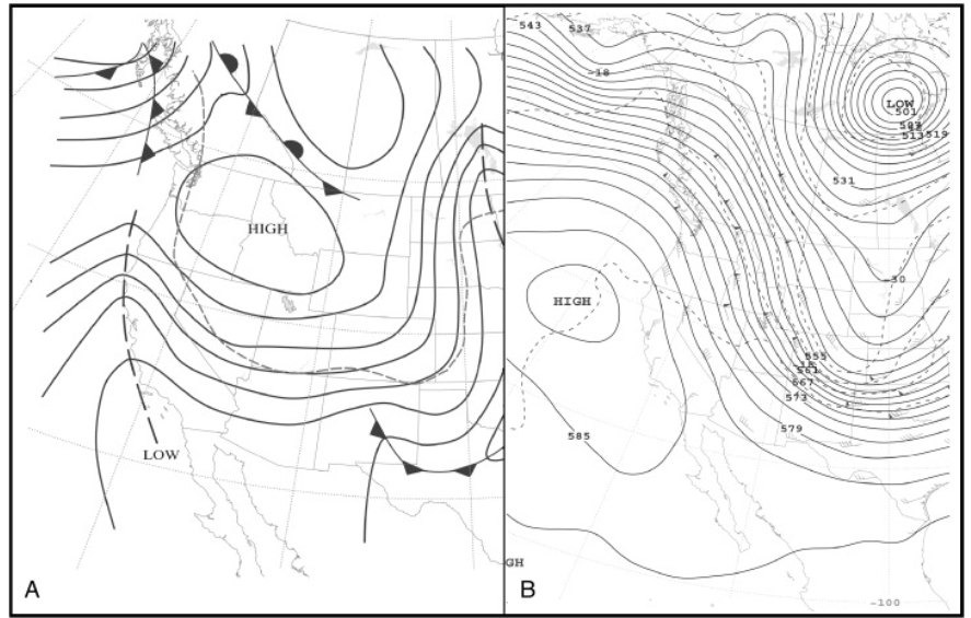
¡Buenos dias! A pass by the Oceansat satellite around midnight confirmed that the next north pulse has arrived, with north winds of around 10 knots over the Sea of Cortez just east of Cerralvo, and winds up to 15 knots as far south as Loreto. Surface high pressure centered far to our northwest over the eastern Pacific was responsible for the surge in north flow, and all of the latest numerical model forecasts show solid north background flow will continue today. Infrared satellite loops early this morning indicated clear skies across our region, so we should get an added thermal boost this afternoon. Model forecasts are in good agreement that just enough north flow will last into Monday to give us a rideable day. The surface pressure gradient over BCS will weaken substantially on Tuesday, with only light winds expected here. Pacific high pressure is then forecast to strengthen and build into the southwestern U.S. on Wednesday into Thursday and bring a return of solid NNW background flow. Long-range model forecasts show the high weakening on Friday, but again there may be just enought north flow left to give us one more good day. At this point it looks like light winds will return again next Saturday.

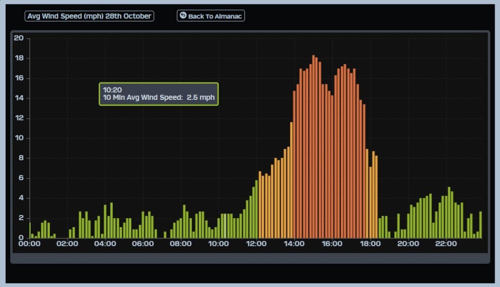
  • Today…Sunny. North wind 18-22 mph.
  • Monday…Sunny. North wind 16-18 mph.
  • Tuesday…Sunny. Northeast wind 10-12 mph.
  • Wednesday…Sunny. North wind 16-20 mph.
  • Thursday…Sunny. North wind 18-22 mph.
  • Friday…Sunny. North wind 16-18 mph.
  • Saturday…Sunny. Northeast wind 10-12 mph.

Wind – November 1, 2025

¡Buenos dias! Light and variable winds were again detected over the southern Sea of Cortez by satellite passes last evening, and all model forecasts show light background flow will continue today. Model forecasts and in good agreement that the surface pressure pattern will tighten over BCS on Sunday, and with sunny skies expected, we will likely see a good thermal boost as well. The background flow will fall to marginal levels on Monday, and at this point it looks like it will be just below the level needed to fully activate our local wind machine. Tuesday will likely be a light wind day as the surface pressure gradient is forecast to be very weak, with only light onshore breezes expected. A return to windy afternoons is likely on Wenesday and Thursday as surface high pressure builds into BCS from the eastern Pacific. Long-range models disagree, but some are showing just enough background flow lasting into Friday to give us another windy afternoon.

  • Today…Sunny. Northeast wind 10-12 mph.
  • Sunday…Sunny. North wind 16-20 mph.
  • Monday…Sunny. North wind 14-16 mph.
  • Tuesday…Sunny. Northeast wind 10-12 mph.
  • Wednesday…Sunny. North wind 16-20 mph.
  • Thursday…Sunny. North wind 18-22 mph.
  • Friday…Sunny. North wind 16-18 mph.

Nerd Note: The U.S. Climate Prediction Center (part of NOAA) just issued its outlook for temperature and precipitation for November, and it shows a continuation of warm and dry conditions for the interior west of the U.S. For us this likely means above normal temperatues and fewer strong nortes as a ridge of high pressure in the middle levels of the atmosphere over the interior west of the U.S. will keep strong surface high pressure systems from descending into the interior west from Canada. The image below shows typical conditions for a developing norte, with a strong mid-level ridge of high pressure along the west coast and strong mid-level trough inland (B). This usually leads to a strong surface high over the interior west of the U.S., with a tight surface pressure gradient over BCS as the surface high builds into the 4-corners region (A). The Climate Prediction Center forecast for November (derived from their text discussion) indicates the opposite mid-level pattern, with a trough of low pressure off the west coast and a ridge of high pressure inland over the interior west.

Wind – October 31, 2025

¡Buenos dias! Light and variable winds were detected over the southern Sea of Cortez by satellite passes last evening, and all of the most recent model forecasts show light background flow will continue today. North flow will increase a bit on Saturday, but at this point it looks like it’ll fall just short of what is usually needed to trigger our local wind machine. Models are in good agreement that the surface pressure gradient will tighten on Sunday, and with full sunshine expected, we will likely see a windy afternoon. Monday will be another on the fence day, with marginal north background flow. At this point Tuesday looks to be a down day, with model forecasts showing a weak surface pressure gradient over BCS. Long-range forecasts are in good agreement that Pacific high pressure will begin to build into our region Wednesday into Thursday, with NNW bacground flow increasing.

  • Today…Sunny. East wind 8-10 mph.
  • Saturday…Sunny. Northeast wind 10-12 mph.
  • Sunday…Sunny. North wind 16-20 mph.
  • Monday…Sunny. North wind 14-16 mph.
  • Tuesday…Sunny. Northeast wind 10-12 mph.
  • Wednesday…Sunny. North wind 16-20 mph.
  • Thursday…Sunny. North wind 18-22 mph.

Wind – October 30, 2025

¡Buenos dias! An evening pass by one of the polar-orbiting satellites measured 5 knot NW winds over the southern Sea of Cortez, and all of the most recent model forecasts continue to show a very weak background flow for today, with only a summer-like onshore breeze developing this afternoon. Similar conditions are expected on Friday, and it now appears that although we should see a return of north flow on Saturday, it will likely be too weak to fully energize our local wind machine. Models are in good agreement that we will see the surface pressure gradient tighten on Sunday, and with full sunshine expected we should see a windy afternoon. At this point the long-range model forecasts look marginal at best for Monday and Tuesday, as the surface pressure gradient again becomes weak, but a new pulse of north flow could arrive as early as Wendesday.

  • Today…Sunny. East wind 8-10 mph.
  • Friday…Sunny. East wind 8-10 mph.
  • Saturday…Sunny. Northeast wind 10-12 mph.
  • Sunday…Sunny. North wind 16-20 mph.
  • Monday…Sunny. Northeast wind 10-12 mph.
  • Tuesday…Sunny. Northeast wind 10-12 mph.
  • Wednesday…Sunny. North wind 16-20 mph.

Wind – October 29, 2025

¡Buenos dias! The wind gauge at the campground showed an unusual profile with two peaks yesterday…one from around 2-3:30, then another late one from around 4:30-5:30 (see graph below). Satellite passes yesterday afternoon indicated that the second peak was a new surge of north background flow, however it arrived a bit too late to fully team up with our local thermal, so winds only peaked at around 18 mph instead of the 20-24 mph I expected. A satellite pass last evening measured 10 knot NW winds over much of the southern Sea of Cortez, and forecast models show similar backgroud flow will continue today. With another sunny day ahead we will likely see a substantial thermal boost, and with north background flow already in place, we should see a more normal wind profile, with winds increasing by around midday. A sprawling ridge of high pressure covering much of the western U.S. this morning will weaken quickly tonight, leaving a weak surface pressure gradient with only light onshore flow expected Thursday and Friday. Forecast models are in fairly good agreement that Canadian high pressure will work its way southeastward and bring a new pulse of north flow to BCS…possibly as early as Saturday afternoon. Sunday looks to be the windiest day of the upcoming weekend, and long-range model forecast show just enough north background flow may last into Monday. At this point it looks like Tuesday will be another light wind day as the surface pressure gradient over our region becomes very weak.

  • Today…Sunny. North wind 16-20 mph.
  • Thursday…Sunny. East wind 8-10 mph.
  • Friday…Sunny. East wind 8-10 mph.
  • Saturday…Sunny. North wind 16-18 mph.
  • Sunday…Sunny. North wind 16-20 mph.
  • Monday…Sunny. North wind 16-18 mph.
  • Tuesday…Sunny. East wind 8-10 mph.

Wind – October 28, 2025

¡Buenos dias! A satellite pass measured northwest winds of 10 knots over the southern Sea of Cortez around midnight, but farther north near Santa Rosalia, a new surge of north winds was detected. The latest numerical model forecasts show this new surge of north flow making its way steadily southward today and likely reaching us by mid-late afternoon. Infrared satellite loops show clear skies across our region, and while we will likely see rideable winds with an early afternoon thermal bump, it may be a relatively late show as the new surge of north background flow arrives. Model forecasts are once again in excellent agreement that surface high pressure centered over Idaho this morning will build southeastward on Wednesday, with solid north background flow continuing over BCS. We’ll get a couple of rest days on Thursday and Friday as the surface pressure gradient becomes weak, with only light onshore breezes expected. Long-range model forecasts show surface high pressure over British Columbia will build into the interior west of the U.S. on Saturday, with a fresh pulse of north flow making its way down the Sea of Cortez. Solid north flow will likely continue at least through Sunday and possibly into Monday.

  • Today…Sunny. North wind building to 20-24 mph.
  • Wednesday…Sunny. North wind 16-20 mph.
  • Thursday…Sunny. East wind 8-10 mph.
  • Friday…Sunny. East wind 8-10 mph.
  • Saturday…Sunny. North wind 16-18 mph.
  • Sunday…Sunny. North wind 16-20 mph.
  • Monday…Sunny. North wind 16-18 mph.

Wind – October 27, 2025

¡Buenos dias! A pass by one of the polar orbiting satellites around midnight showed yesterday’s strong north background flow had decreased overnight, with 10 knot NW winds detected over the southern Sea of Cortez. Although the background flow will be substantially less today, several model forecasts do show just enough remaining to help jump-start our local wind machine. A band of high clouds over us this morning will quickly move eastward and leave full sunshine by midday, so we’ll also get a substantial thermal boost this afternoon. Surface high pressure centered over the Pacific Northwest of the U.S. today will build southeastward on Tuesday, with the surface pressure gradient tightening over BCS and north flow increasing. Some thin, high clouds may stream over from time to time, but enough filtered sunshine should make it through to give us a good thermal boost as well. The surface high will then move rapidly southeastward into western Texas on Wednesday and maintain a solid north background flow over our region. Model forecasts are in excellent agreement that the background flow will then rapidly weaken on Thursday, with summerlike onshore breezes expected both Thursday and Friday. A new surface high is then forecast to build into the 4-corners region of the U.S. just in time for the weekend, with solid north background flow returning on Saturday and continuing through at least Sunday.

  • Today…Some morning high clouds, then becoming sunny. North wind 16-18 mph.
  • Tuesday…Mostly sunny. North wind 20-24 mph.
  • Wednesday…Sunny. North wind 16-20 mph.
  • Thursday…Sunny. East wind 8-10 mph.
  • Friday…Sunny. East wind 8-10 mph.
  • Saturday…Sunny. North wind 16-18 mph.
  • Sunday…Sunny. North wind 16-20 mph.

Nerd Note: A potentially catastrophic event is unfolding for the island nation of Jamaica, as a hurricane hunter aircraft early this morning showed hurricane Mellisa has become a category 5 storm with sustained winds of 160 mph. The storm is expected to make landfall on the southernwestern coast of Jamaica tonight. Here is a visible satellite image from just after sunrise showing the dark, clear eye, and sunlight reflecting off the western eyewall showing the spectacular stadium effect as the eyewall flares outward with height.

wind – October 26, 2025

¡Buenos dias! An Oceansat satellite pass around midnight measured solid 15 knot NW winds over the southern Sea of Cortez. All of the most recent numerical model forecasts show that while the background flow weakened early this morning, it should build again and reach a mid-afternoon peak today. Infrared satellite loops showed some thin, high clouds streaming in early this morning…blowoff from Tropical Storm Sonia far to our southwest…but plenty of sunshine should filter through this afternoon to give us an added thermal boost. The background flow is forecast to weaken on Monday, but just enough north flow will likely remain to help jump-start our local wind machine. Model forecasts are in excellent agreement for the remainder of the week, with a new area of high pressure building into the interior west of the U.S. on Tuesday and north background flow increasing over BCS. The surface pressure gradient over BCS will weaken a bit on Wednesday, but at this point it looks like ample north background flow will continue and with full sunshine expected, we should see a windy afternoon. Thursday and Friday will likely be down days as the background flow over BCS becomes very light. Long-range model forecasts show a new area of high pressure building into the interior west of the U.S. on Saturday, with north flow returning to BCS.

  • Today…Mostly sunny. North wind building to 20-24 mph.
  • Monday…Mostly sunny. North wind 16-18 mph.
  • Tuesday…Mostly sunny. North wind 20-24 mph.
  • Wednesday…Sunny. North wind 16-20 mph.
  • Thursday…Sunny. East wind 8-10 mph.
  • Friday…Sunny. East wind 8-10 mph.
  • Saturday…Sunny. North wind 16-18 mph.

Wind – October 24, 2025

Note: I will be out of network range on Saturday, so the forecast will not be updated until Sunday morning.

¡Buenos dias! Satellite passes last evening measured south winds of around 5 knots over much of the southern Sea of Cortez. A relatively weak area of high pressure was centered near Salt Lake City early this morning, and model forecasts are in good agreement that this feature will build south…southeastward today, bringing marginal NNE background flow to our region by mid afternoon. It’ll likely be one of those days right on the edge of rideable, as models also show full sunshine is expected. The weak surface high is then forecast to build into western New Mexico on Saturday and further tighten the surface pressure gradient over BCS, with north background flow increasing here. Solid north flow is expected to continue through Sunday as the surface high remains nearly stationary to our north, and with another sunny day expected, we should see a windy afternoon. Forecast models are in good agreement that a new area of high pressure will build into the Pacific Northwest of the U.S. on Monday, then into the interior west of the U.S. on Tuesday. This will likely keep solid north background flow over BCS through at least Tuesday and with sunny skies expected our local thermal should be in fine form each afternoon. Long-range model forecasts are in good agreement that the surface pressure gradient will become weak on Wednesday, with light background flow continuing into Thursday.

  • Today…Sunny. Northeast wind 12-14 mph…maybe more.
  • Saturday…Sunny. North wind 16-18 mph.
  • Sunday…Sunny. North wind 16-20 mph.
  • Monday…Sunny. North wind 16-18 mph.
  • Tuesday…Sunny. North wind 16-18 mph.
  • Wednesday…Sunny. East wind 8-10 mph.
  • Thursday…Sunny. East wind 8-10 mph.

Wind – October 23, 2025

¡Buenos dias! After another 5+ hours of great conditions yesterday, today will be a rest day as a satellite pass late last evening confirmed model forecasts of relatively light background flow over the southern Sea of Cortez. Models show a weak surface high will begin to build into the western U.S. on Friday, but it looks like only marginal northeast flow at best will reach us. The surface high is forecast to move into the 4-corners region on Saturday, and this should tighten the surface pressure gradient over BCS just enough to jump start our local wind machine. Model forecasts are in good agreement that sufficient north background flow should then last for several days as a weak ridge of high pressure remains to our north. Long-range forecasts indicate that winds may become marginal again by next Wednesday.

  • Today…Sunny. East wind 8-10 mph.
  • Friday…Sunny. Northeast wind 10-12 mph.
  • Saturday…Mostly sunny. North wind 16-18 mph.
  • Sunday…Mostly sunny. North wind 16-20 mph.
  • Monday…Sunny. North wind 16-18 mph.
  • Tuesday…Sunny. North wind 16-18 mph.
  • Wednesday…Sunny. North wind 14-16 mph.