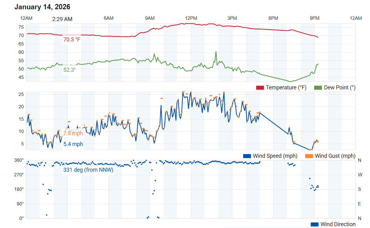
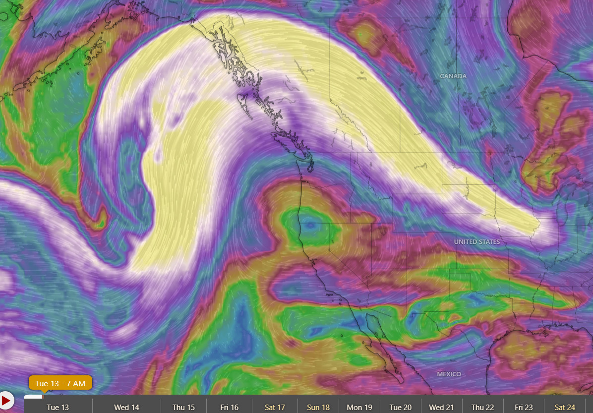
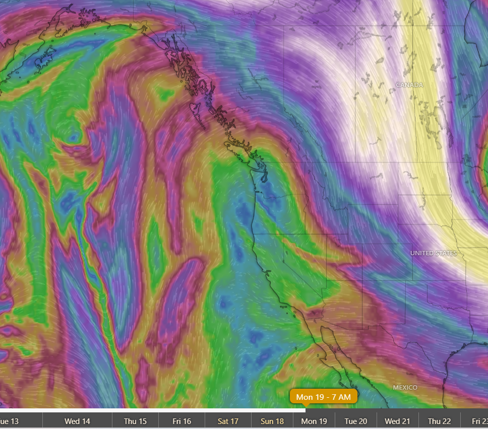
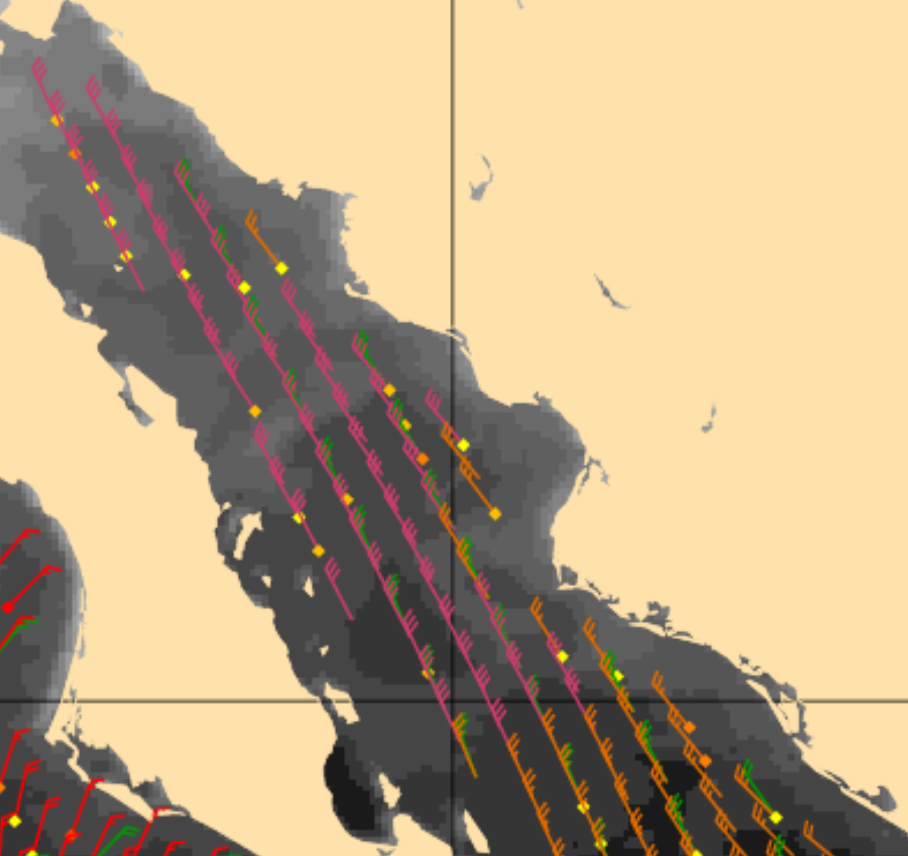
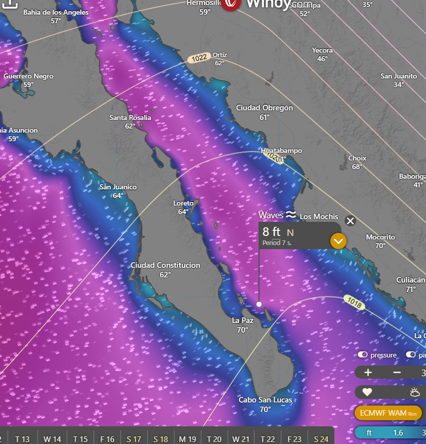
¡Buenos dias! The Oceansat satellite measured NW winds of 15 knots just east of Cerralvo late last evening, and forecast models are in good agreement that solid NW background flow will continue today. The forecast for today is a low-confidence one, as while we will see ample NW background wind, the main controlling factor will be cloud cover. Infrared satellite loops early this morning showed a large area of mid and high-level clouds to our south was moving northward into BCS, and all of the model forecasts show substantial cloud cover this afternoon. It's going to be one of those days where if we get any substantial breaks in the cloud cover, we could see just enough of a thermal to give us rideable winds, but it will be close. Clouds should thin a bit on Tuesday, and with ample background flow forecast to continue, we should see a windy afternoon. At this point it looks like our game of cat and mouse with the cloud cover will see a break on Wednesday, as model forecasts show full sunshine will return and likely give us a good thermal boost. Substantial cloud cover will again creep into BCS on Thursday, but at this point I'll be optimistic that we'll see some thin spots and at least a partial thermal boost. Our long stretch of windy days (18 and counting) will likely come to an end on Friday, as long-range model forecasts show a deep trough of low pressure primarily in the mid-levels of the atmosphere will drop southward into the Baja Peninsula and create a very weak surface pressure gradient with light background flow over our region. Thick cloud cover will also be drawn into BCS, and we may even see a few showers on Saturday. Extended-range model forecasts disagree on how fast this system will move off to the east, but at this point it looks like light winds will continue through Sunday.
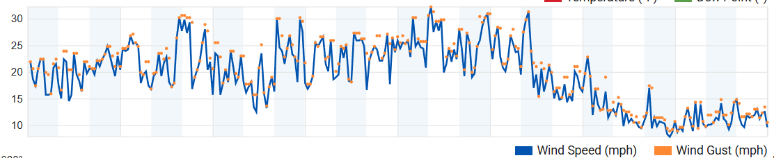
(Tides)- Today…Partly sunny. North wind 16-18 mph.
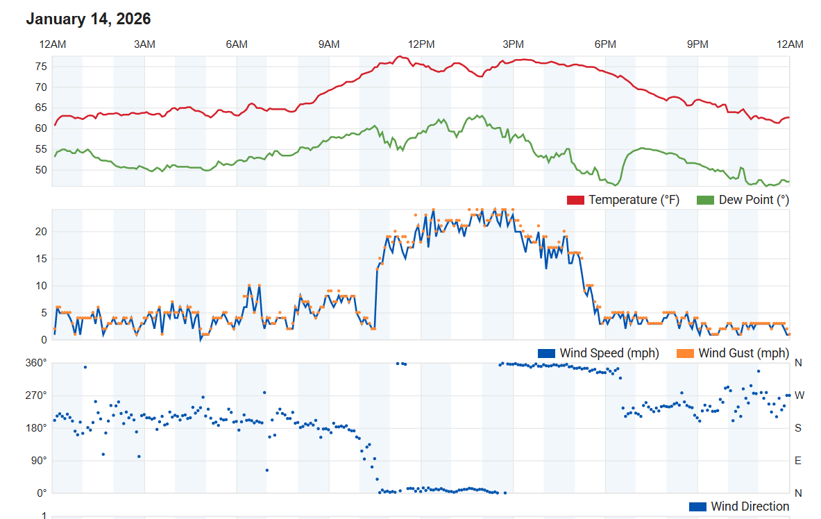
- Tuesday…Mostly sunny. North wind 16-18 mph.
- Wednesday…Sunny. North wind 16-20 mph.
- Thursday…Mostly sunny. North wind 16-18 mph.
- Friday…Mostly cloudy. Northeast wind 8-10 mph.
- Saturday…Mostly cloudy with a few showers possible. Northeast wind 8-10 mph.
- Sunday…Partly sunny. Light and variable wind.