Wind – December 1, 2025

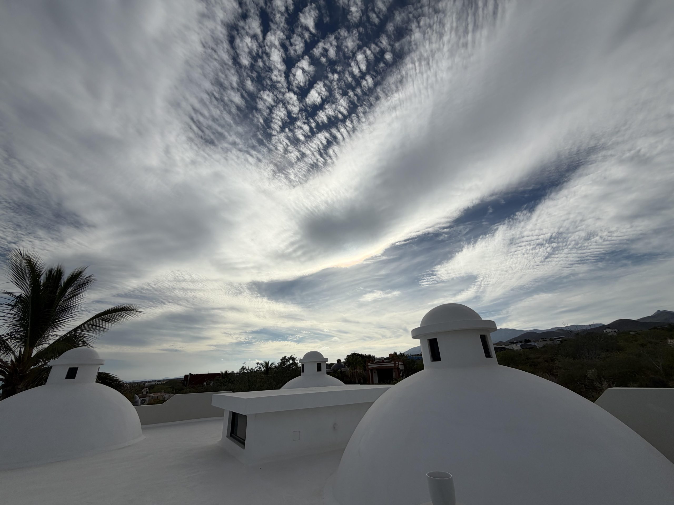
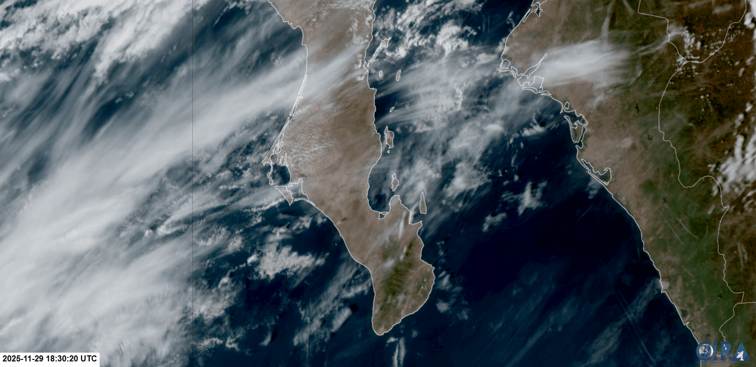
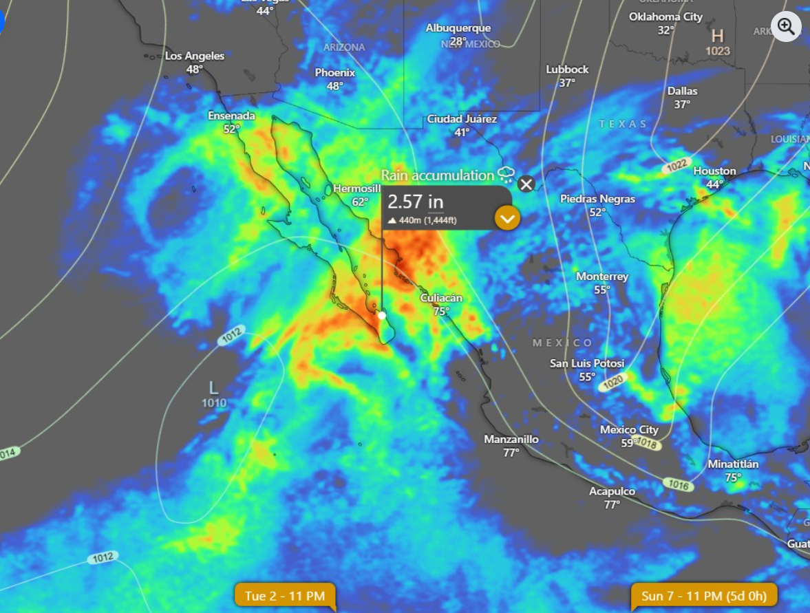
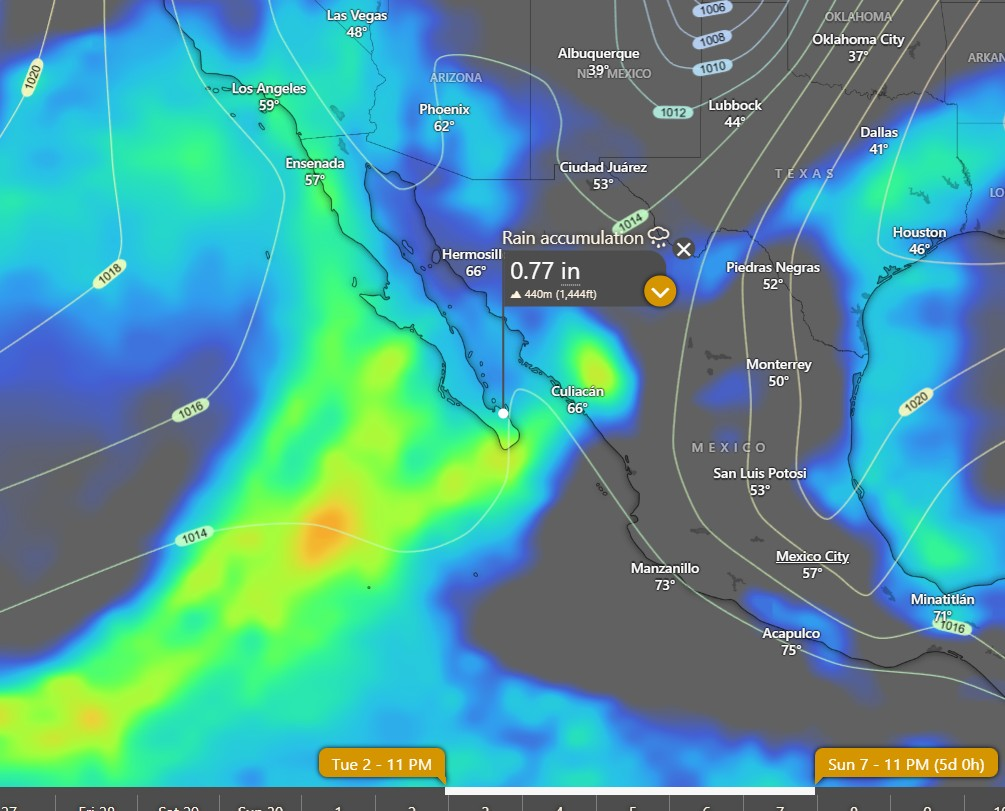
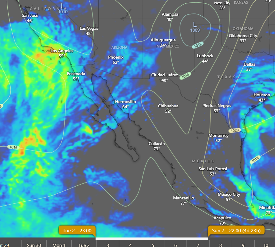
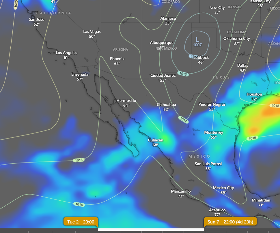
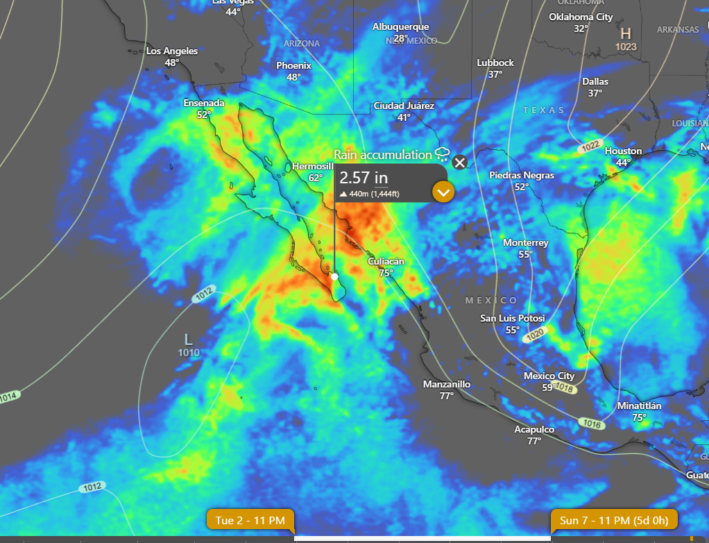
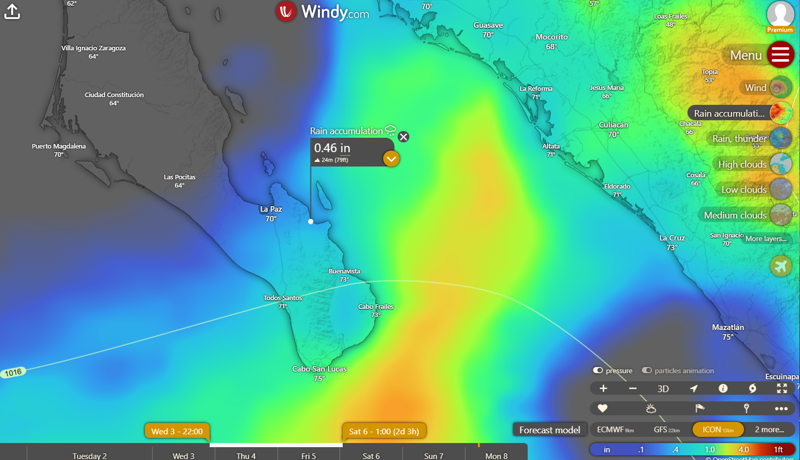
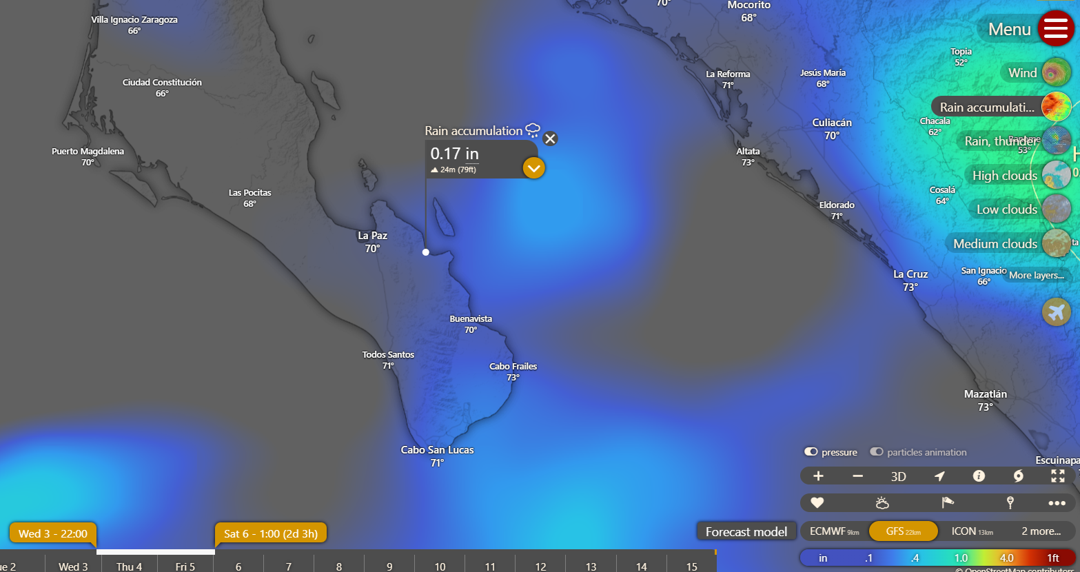
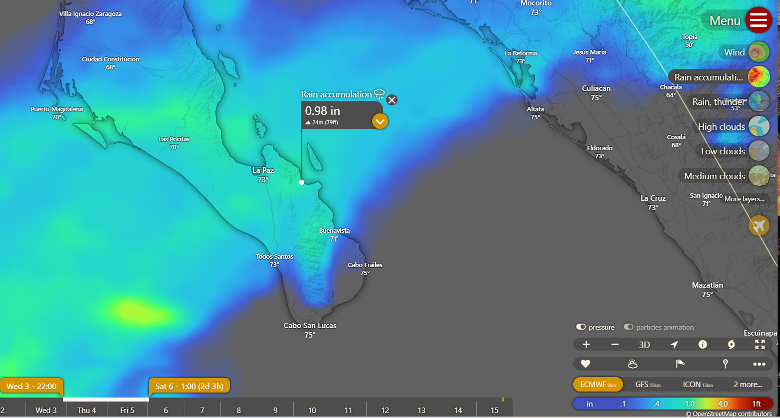
¡Buenos dias! A late-evening pass by one of the ASCAT satellites measured NW winds of around 5 knots just east of Cerralvo, and model forecasts show marginal background north flow for today. Infrared satellite loops early this morning indicated more clouds streaming in from the southwest, and although we may see some brief breaks in the cloud cover this afternoon, they probably will not be enough to trigger our local thermal. Tuesday still looks to be our best chance to see rideable winds for the next several days, as surface high pressure builds into the 4-corners region of the U.S. and models show clouds should temporarily thin out. The doldrums will return on Wednesday as the surface pressure gradient once again becomes weak, and cloud cover thickens. Model forecasts are in good agreement that a deep trough of low pressure in the mid and upper levels of the atmosphere lurking off the Baja Peninsula on Wednesday will begin a slow slog eastward Thursday into Friday. Although the model forecasts vary in their predicted rainfall amounts, the latest forecast runs show it is becoming more likely that we will at least some rainfall Thursday into Friday (see graphics below). Of course this could change so stay tuned. As this vigorous system moves across the Baja Peninsula Thursday into Friday, our winds will likely remain light as thick cloud cover buries our local thermal. There is hope on the horizon though, as long-range forecasts agree that surface high pressure will build into the southwestern U.S. on Saturday and tighten the surface pressure gradient over BCS with increasing north background flow. Lingering moisture will likely lead to some low clouds on Saturday, but enough sun should filter through to at least partially trigger our thermal. Full sunshine should finally return on Sunday, and with solid north flow continuing, we will likely see a windy day.


(Tides)
  • Today…Mostly cloudy. Northeast wind 10-12 mph.
  • Tuesday…Partly sunny. North wind 16-18 mph.
  • Wednesday…Mostly cloudy with a few showers possible. Light and variable wind.
  • Thursday…Cloudy with scattered showers. North wind 8-10 mph.
  • Friday…Cloudy with rain likely. North wind 10-12 mph.
  • Saturday…Partly sunny. North wind 16-20 mph.
  • Sunday…Sunny. North wind 16-20 mph.

Wind – November 30, 2025

¡Buenos dias! All of the polar orbiting satellites missed BCS last evening, but the latest model forecasts show light west to northwest winds over our area today. In addition…infrared satellite loops early this morning showed more high clouds cover streaming in from the southwest (see nerd note below), so our thermal will likely be a no-show as well. Monday looks to be another down day as the surface pressure gradient remains weak over BCS and high clouds dampen our local thermal. The latest model forecasts still hold some hope that Tuesday will bring rideable winds as north background flow increases and the cloud cover thins a bit. Models then show moisture from deep in the tropics to our southwest will be drawn into BCS on Wednesday and Thursday, with more clouds and even a few showers possible. A weak surface pressure gradient with very light background flow will return as well on Wednesday, so a down day appears likely. Surface high pressure will begin building into the interior west of the U.S. on Thursday and north flow will likely increase over our region, but significant cloud cover will continue to dampen our thermal. We should finally begin to crawl out of this wind drought on Friday, as long-range models show surface high pressure building into the 4-corners region of the U.S. and the surface pressure gradient tightening over BCS. Some low clouds and sprinkles may linger into Friday, but we should see at least some sunshine during the afternoon. Saturday looks to be a return to more normal La Ventana conditions, with solid north background flow and sunny skies combining to give us a windy day.

Nerd Note: Some of you may have noticed the strange-looking clouds over us yesteday (see picture below). They are called mountain wave clouds or lenticular clouds, and are caused by strong winds being forced up and over a mountain range in a relatively stable environment. Here is a satellite loop from yesterday afternoon. Notice the elongated clouds over the mountains just to our southwest remain stationary while the rest of the high clouds race from southwest to northeast across BCS.

(Tides)
  • Today…Mostly cloudy. Light and variable wind.
  • Monday…Mostly cloudy. Northeast wind 8-10 mph.
  • Tuesday…Partly sunny. North wind 16-18 mph.
  • Wednesday…Mostly cloudy with a few showers possible. Light and variable wind.
  • Thursday…Mostly cloudy with scattered showers. North wind 12-14 mph.
  • Friday…Partly sunny with a few sprinkles possible. North wind 16-18 mph.
  • Saturday…Sunny. North wind 18-22 mph.

Wind – November 29, 2025

¡Buenos dias! An evening pass by one of the ASCAT polar-orbiting satellites measured light and variable winds near Cerralvo, and almost all of the latest model forecasts show light background NW flow today, so odds are that we’ll see marginal winds this afternoon. I will mention that one of the more reliable models, the ECMWF, does show a pulse of north flow later this afternoon, but it’s definitely the odd man out. Infrared satellite loops show some significant clearing to our west early this morning, and model forecasts show numerous thin patches in the high cloud cover today, so IF the ECMWF model verifies, we could see a bonus afternoon. My best advice for today is since for most of this week we’ll be scrounging for scraps, it’s best to be ready just in case the Europeans once again prevail. The remainder of the forecast through Wednesday looks to be on track, with Tuesday as the only day we will likely see rideable wind. Big differences begin to show in the long-range forecasts on Thursday, and once again the European model is the outlier…showing a surface low pressure system off the northern Baja Peninsula on Thursday moving excruciatingly slowly eastward and keeping our background flow light through next weekend. Other models are more optimistic that surface high pressure will begin to build into the Baja Peninsula on Friday, with solid north flow returning. Stay tuned.

(Tides)

  • Today…Partly sunny. North wind 10-12 mph.
  • Sunday…Cloudy. Light and variable wind.
  • Monday…Mostly cloudy. Northeast wind 8-10 mph.
  • Tuesday…Partly sunny. North wind 16-18 mph.
  • Wednesday…Mostly cloudy. Light and variable wind.
  • Thursday…Partly sunny. North wind 12-14 mph.
  • Friday…Mostly sunny. North wind 16-18 mph.

Wind – November 28, 2025

¡Buenos dias! Model forecasts of decreasing northwest winds over the southern Sea of Cortez were verified by a midnight pass of the Oceansat satellite which measured NW winds of 5-10 knots near Cerralvo. The forecast for today is a low-confidence one, as the latest batch of model forecasts show NNW background winds will hover very near the lower threshold to help trigger our wind machine this afternoon. Cloud cover will be another big variable today, with some high clouds forecast to move in from the southwest. That said, some of the models show significant breaks in the cloud cover today, so I’ll be optimistic that we’ll see rideable winds. The vast majority of model forecasts show light background flow will continue through Monday, and with significant cloud cover expected each day, there is a good chance that we will see a string of light wind days Saturday through Monday. A pulse of north wind is expected to arrive on Tuesday, and if we’re lucky we may see enough breaks in the cloud cover to at least partially trigger our local thermal. Long-range model forecasts show that the background wind will again become light on Wednesday into Thursday, and with significant cloud cover also expected, we will likely see very light winds.

Nerd Note: The possibility of heavy rain for BCS we talked about a couple of days ago has diminished in the most recent extended range model runs, with only the GFS model still showing the possibility of around 1/2 inch of rain. Both the low-level disturbance from deep in the tropics and the mid and upper-level storm system that were forecast to move over BCS from Wednesdsay through Sunday are now forecast to remain well to our west through Saturday, then track much farther to our north on Sunday. This is a good example of how slight differences in the initial weather pattern can induce major shifts in large-scale weather forecasts beyond about 7 days. Below are the forecasts from Wednesday and the current forecasts for total rainfall from next Wednesday through Sunday, December 7. Of course this can still change significantly…stay tuned.


(Tides)

  • Today…Partly sunny. North wind 14-16 mph.
  • Saturday…Partly sunny. Northeast wind 10-12 mph.
  • Sunday…Mostly cloudy. Light and variable wind.
  • Monday…Partly sunny. Northeast wind 8-10 mph.
  • Tuesday…Partly sunny. North wind 16-18 mph.
  • Wednesday…Mostly cloudy. Light and variable wind.
  • Thursday…Mostly cloudy. Light and variable wind.

Wind – November 27, 2025

¡Buenos dias! Northwest winds of 15 knots were measured near us by an Oceansat satellite pass last night just after midnight, and model forecasts are in good agreement that significant north…northwest background wind will continue today. Infrared satellite loops early this morning showed patches of high clouds continuing to stream into BCS from the southwest, but significant clear areas were also noted. Model forecasts show we should see some sun filtering through today, so I’ll be optimistic that we will see enough to give us a significant thermal boost this afternoon. Surface high pressure centered near the 4-corners region of the U.S. will continue to bring ample north background wind to BCS on Friday, but increasing high clouds could dampen our afternoon thermal. The surface pressure gradient will the become very weak over BCS on Saturday, with only light winds expected. Similar conditions will likely last through Monday, with light winds and significant cloud cover. Model forecasts are in good agreement that surface high pressure will build into the southwestern U.S. on Tuesday and bring a new pulse of north wind to BCS, but it will likely be short-lived as long-range model forecasts show light winds returning on Wednesday.

(Tides)

  • Today…Mostly sunny. North wind 16-20 mph.
  • Friday…Partly sunny. North wind 16-18 mph.
  • Saturday…Partly sunny. Northeast wind 8-10 mph.
  • Sunday…Mostly cloudy. Light and variable wind.
  • Monday…Partly sunny. Northeast wind 8-10 mph.
  • Tuesday…Partly sunny. North wind 16-18 mph.
  • Wednesday…Mostly cloudy. Light and variable wind.

Wind – November 26, 2025

¡Buenos dias! One of the polar-orbiting satellites measured 15 knot NNW winds just east of Cerralvo around midnight as surface high pressure centered over northern Utah maintained a farily tight surface pressure gradient over BCS. The wild card today will be the thickness of high cloud cover, as all of the most recent model forecasts show a band of high clouds to our west will move over BCS by mid morning and may significantly dampen our local thermal. Model forecasts are in good agreement that the surface high will move into the 4-corners area of the U.S. on Thursday then begin to weaken on Friday, with north background flow continuing over our region. Although models show some high clouds will stream in from the southwest Thursday into Friday, there may be some thin spots in the cloud cover and we could see just enough filtered sunshine to at least partially trigger our thermal. The background flow over BCS will likely become light on Saturday as the surface pressure gradient becomes very weak. Surface low pressure is then forecast to move from northern Arizona Sunday eastward into west Texas on Monday, and this will continue our streak of down days. A weak pulse of north flow may reach us on Tuesday, but model forecasts are in good agreement that we will still see abundant high clouds so our local thermal may be relatively anemic.

Nerd Note: Over the past week or so the long-range global models have been hinting at a possible significant rain event beginning Wednesday of next week and continuing through the following weekend. Model forecasts are now in fairly good agreement that a mid to upper-level low pressure system will track from west to east across the Baja Peninsula on Wednesday. Circulation around this system may drag a weak surface low from deep in the tropics to our southwest…northeastward into BCS on Wednesday with widespread showers and maybe even a few thunderstorms. Very unsettled weather is then forecast to continue Thursday possibly into the following Sunday as a very strong mid and upper-level storm system dives southward from California into BCS and then moves very slowly eastward…producing an extended period of showers and isolated thunderstorms. Below are 2 graphs showing model forecasts of cumulative rainfall from Wednesday, December 3 through Sunday, December 7. In addition to the rain, models are in good agreement that we will also see very light winds during that period.

(Tides)

  • Today…Increasing high clouds. North wind 16-18 mph.
  • Thursday…Mostly sunny. North wind 16-20 mph.
  • Friday…Mostly sunny. North wind 16-18 mph.
  • Saturday…Mostly sunny. Northeast wind 8-10 mph.
  • Sunday…Partly sunny. Light and variable wind.
  • Monday…Partly sunny. Light and variable wind.
  • Tuesday…Partly sunny. North wind 14-16 mph.

Wind – November 25, 2025

¡Buenos dias! NNW winds of 15 knots were measured by an Oceansat satellite around midnight, and all of the most recent batch of model forecasts show solid north…northwest flow will continue today. Some morning low clouds will thin by around noon and with lots of sunshine expected this afternoon we should see a significant local thermal accelerate and pull the winds onshore. Surface high pressure over the western U.S. will remain in place through Thursday and give us more than enough north background flow to continue this windy streak of days. Models are in good agreement that the suface high will weaken on Friday, but at this point it looks like we may have just enough background north flow remaining for one more good day. While the long-range models disagree on some details, a light wind weather pattern will likely begin on Saturday and extend into Monday.

(Tides)

  • Today…A few morning clouds then becoming sunny. North wind 20-24 mph.
  • Wednesday…Mostly sunny. North wind 18-22 mph.
  • Thursday…Mostly sunny. North wind 18-22 mph.
  • Friday…Mostly sunny. North wind 16-18 mph.
  • Saturday…Mostly sunny. Northeast wind 8-10 mph.
  • Sunday…Mostly cloudy. Light and variable wind.
  • Monday…Mostly cloudy. Light and variable wind.

Wind – November 24, 2025

¡Buenos dias! An Oceansat satelllite pass around midnight measured NNW winds of 10-15 knots just east of Cerralvo. Surface high pressure centered off the west coast of the U.S. this morning will build eastward today and maintain a tight surface pressure gradient over BCS. Infrared satellite loops early this morning showed a patch of high clouds over BCS, but all of the model forecasts show clearing skies later this morning, so we should see a good thermal boost this afternoon. Model forecasts agree that the surface high to our north will maintain solid north background flow through at least Thursday. Some high clouds will begin to stream in from the southwest on Wednesday and continue into Thursday, but models indicate there should be plenty of thin spots to allow at least some filtered sunshine in and trigger our local thermal each day. North background flow will then weaken on Friday, but just enough might remain to combine with sunny skies and give us one more rideable day. Although there are some timing differences, the long-range global models generally agree that a light wind pattern will begin on Saturday and continue through the next weekend.

(Tides)

  • Today…A few morning clouds then becoming sunny. North wind 20-24 mph.
  • Tuesday…Sunny. North wind 18-22 mph.
  • Wednesday…Mostly sunny. North wind 18-22 mph.
  • Thursday…Mostly sunny. North wind 16-20 mph.
  • Friday…Sunny. North wind 16-18 mph.
  • Saturday…Mostly sunny. Northeast wind 8-10 mph.
  • Sunday…Mostly cloudy. Light and variable wind.

Wind – November 23, 2025

¡Buenos dias! An Oceansat satellite pass around midnight measured 15-20 knot WNW winds near Cerralvo as Pacific high pressure began building into BCS. Model forecasts are in excellent agreement that the WNW background flow will gradually become more northerly by mid-afternoon today, and with only a few high clouds expected, our local thermal should be able to pull the winds onshore. The surface pressure gradient will continue to tighten on Monday as high pressure builds into the western U.S., with borderline norte condtions likely developing here with the usual gusty N to NNW winds and increasing swell. The remainder of the forecast looks to be on track, as surface high pressure to our north will keep a solid north flow going through at least Thursday. At this point it appears that we still may have just enough north background wind on Friday for one more rideable day, but Saturday looks to be a down day as surface low pressure develops far to our north.

(Tides)

  • Today…Mostly sunny. North wind 16-20 mph.
  • Monday…Mostly sunny. North wind 20-24 mph and gusty.
  • Tuesday…Sunny. North wind 18-22 mph.
  • Wednesday…Mostly sunny. North wind 18-22 mph.
  • Thursday…Mostly sunny. North wind 16-20 mph.
  • Friday…Sunny. North wind 16-18 mph.
  • Saturday…Sunny. Northeast wind 8-10 mph.

Wind – November 22, 2025

¡Buenos dias! A satellite pass last evening measured very light south winds near Cerralvo, and all of the latest forecast models continue to show light winds for today. Surface low pressure responsible for our light winds will move across the northern Baja Peninsula today, then surface high pressure will begin building into our region from the Pacific on Sunday. Although some model forecasts show some west component to the background flow tomorrow, I’ll be optimistic for now that full sunshine will draw the background NNW wind onshore during the afternoon. Models are in excellent agreement that surface high pressure will strengthen as it builds into the western U.S. on Monday, with low-end norte conditions developing here. The norte should subside a bit on Tuesday, but surface high pressure is forecast to remain parked over the interior west of the U.S. through Friday, with north background flow only slowly decreasing Thursday and Friday.

(Tides)

  • Today…Mostly sunny. West wind 10-12 mph.
  • Sunday…Sunny. North wind 16-20 mph.
  • Monday…Mostly sunny. North wind 20-24 mph.
  • Tuesday…Sunny. North wind 18-22 mph.
  • Wednesday…Mostly sunny. North wind 18-22 mph.
  • Thursday…Mostly sunny. North wind 16-20 mph.
  • Friday…Sunny. North wind 16-18 mph.