Wind – November 21, 2025

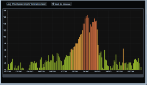
¡Buenos dias! An Oceansat satellite pass around midnight confirmed model predictions of decreasing NNW winds over the Sea of Cortez, and all of the most recent numerical model forecasts show very light background flow for today. Surface low pressure lurking off the far northern Baja Peninsula this morning will move slowly inland on Saturday, and circulation around this system will produce northwest to west background winds over BCS. Pacific high pressure will begin building into the Baja Peninsula on Sunday, with increasing NNW winds here. We will see a sunny day on Sunday, so our local thermal should be able to pull most of the west component out of the background flow, but some of the northern beaches may see some wind shadowing and gusty conditions. Surface high pressure will then build into much of the western U.S. on Monday, and with a tightening surface pressure gradient over BCS, we may see norte conditions develop. While norte conditions will likely subside on Tuesday, moderate north background flow is forecast to continue. The surface high is then forecast to build into the 4-corners region of the U.S. on Wednesday and remain in place through Thursday, with solid north background winds continuing here. Sunny to mostly sunny skies should trigger our local thermal as well, with an added thermal boost each day.

(Tides)

  • Today…Sunny. Northeast wind 10-12 mph.
  • Saturday…Sunny. West wind 10-12 mph.
  • Sunday…Sunny. North/northwest wind 16-20 mph.
  • Monday…Mostly sunny. North wind 20-24 mph.
  • Tuesday…Sunny. North wind 18-22 mph.
  • Wednesday…Mostly sunny. North wind 18-22 mph.
  • Thursday…Sunny. North wind 16-20 mph.

Wind – November 20, 2025

¡Buenos dias! Yesterday was a great example of the sensitivity of our local thermal to cloud cover, as we got an unexpected partial thermal bump especially at southern beaches where the campground showed 10 minute average wind speeds of 13-16 mph from around 1:30 pm until 5 pm. Satellite imagery showed a very fortunate localized clearing trend yesterday morning…lasting into the early afternoon over the plains (see image below), and that was just enough. Infrared satellite loops early this morning indicated the last of the cloud cover was moving off to the east, and with surface high pressure forecast to build into the central Baja Peninsula today, model forecasts are in excellent agreement that north flow will increase from its anemic levels of late. Unfortunately the wind party will be a short one, as model forecasts continue to indicate light winds returning on Friday as surface low pressure approaches the northern Baja Peninsula. The low will move slowly eastward on Saturday, with light winds continuing over BCS. Models continue to be in good agreement that Pacific high pressure will build into our region on Sunday, with north flow again increasing. Surface high pressure will then begin building into the interior of the western U.S. on Monday, and as this happens, the surface pressure gradient over BCS will tighten further, with norte conditions possible. Long-range model forecasts are in very good agreement that surface high pressure will remain in place to our north through at least Friday, with solid north background flow continuing.


(Tides)

  • Today…Sunny. North wind 18-22 mph.
  • Friday…Sunny. Northeast wind 10-12 mph.
  • Saturday…Sunny. Northwest wind 8-10 mph.
  • Sunday…Mostly sunny. North wind 16-20 mph.
  • Monday…Mostly sunny. North wind 20-24 mph.
  • Tuesday…Mostly sunny. North wind 18-22 mph.
  • Wednesday…Sunny. North wind 18-22 mph.

Wind – November 19, 2025

¡Buenos dias! An Oceansat satellite pass around midnight measured 10-15 knot NW winds east of Cerralvo, and while model forecasts show decreasing winds this morning, several models indicate the background flow remaining just above the threshold that would normally trigger our local wind machine…on a sunny day. Unfortunately infrared satellite loops this morning show a band of thick middle and high clouds streaming into BCS from the southwest, and all of the recent model forecasts show substantial cloud cover will continue today, and this will likely significantly dampen our local thermal. Full sunshine will return on Thursday, and as a ridge of high pressure builds over the central Baja Peninsula, north winds will increase, and an added thermal boost should bring us a windy afternoon. Thursday night into Friday a storm system just offshore of southern California will drop slowly southward to a point offshore from El Rosario, BC, then move slowly eastward across BC on Saturday. As this happens, circulation around the low will bring us generally light and variable winds both Friday and Saturday. Models are in good agreement that as the low continues eastward on Sunday, surface high pressure will begin to build into the western U.S. and Baja Peninsula, with solid north flow returning here. As the surface pressure gradient continues to tighten on Monday, we may see our first real norte (my loose definition is sustained winds of at least 20 mph that last into or through the night, together with a significant swell). Long-range model forecasts are in good agreement that solid north flow will continue Tuesday and possibly through Thursday of next week.

(Tides)

  • Today…Mostly cloudy. North wind 10-12 mph.
  • Thursday…Sunny. North wind 18-22 mph.
  • Friday…Sunny. Northeast wind 8-10 mph.
  • Saturday…Sunny. Northwest wind 8-10 mph.
  • Sunday…Sunny. North wind 16-20 mph.
  • Monday…Sunny. North wind 20-24 mph.
  • Tuesday…Sunny. North wind 18-22 mph.

Wind – November 18, 2025

¡Buenos dias! As they say…close but no cigar…as a satellite pass yesterday around noon measured NNW winds over the Sea of Cortez near Cerralvo of only around 5 knots-just short of what is usually needed to fully jump-start our wind machine. Northern beaches only saw winds of around 12-14 mph for much of the afternoon, with a late peak of 15 mph around 3:30 pm. Today will present yet another forecast challenge, as while model forecasts are showing NNW background flow will increase, a band of high clouds will likely move in by late morning and at least partially dampen our local thermal. It’ll once again be close, and if we see some thin spots in the cloud cover, winds could easily be stronger than forecast. Clouds are forecast to become even thicker on Wednesday, and at this point it looks like we will have a very weak thermal at best. Full sunshine will likely return on Thursday, and as a ridge of high pressure builds into the central Baja Peninsula, north winds will increase here. Unfortunately the wind party won’t last long, as model forecasts are in good agreement that a low pressure system lurking off the southern California coast on Friday will push the surface ridge southward directly over BCS, with winds becoming very light. As the low moves slowly eastward across the northern Baja Peninsula on Saturday, our winds will likely remain light. Sunday will be a transition day, as surface high pressure will begin building back into our region with NW background flow increasing. At this point it looks like we’ll still see some west component to the winds on Sunday…stay tuned. Long-range model forecasts are in good agreement that surface high pressure will continue to build to our north, with solid north flow expected over BCS.

(Tides)

  • Today…Sunny this morning, then increasing high clouds. North wind 14-16 mph.
  • Wednesday…Mostly cloudy. North wind 10-12 mph.
  • Thursday…Sunny. North wind 18-22 mph.
  • Friday…Sunny. Northeast wind 8-10 mph.
  • Saturday…Sunny. Northwest wind 8-10 mph.
  • Sunday…Sunny. North/northwest wind 16-18 mph.
  • Monday…Sunny. North wind 18-22 mph.

Wind – November 17, 2025

¡Buenos dias! Substantial breaks in the high cloud cover yesterday allowed our local thermal to produce a great day, with winds at the campground averaging 16-20 mph for around 6 hours straight, peaking at 22 mph around 2 pm. An Oceansat satellite pass late last evening measured NW winds of 15 knots over the Sea of Cortez just east of Cerralvo, but all of the latest numerical model forecasts show decreasing northwest background wind today. While all models show the winds decreasing, several do show just enough will remain and combine with sunny skies to jump start our local wind machine. A slow-moving storm system will affect southern California on Tuesday, then move into Arizona on Wednesday. The latest model forecasts show the effects of this system may stay far enough to our north to allow just enough north background flow to remain tomorrow, and possibly into Wednesday. As that system moves eastward, a ridge of high pressure located near us will retreat northward on Thursday and allow our north winds to increase. At this point it looks like we’ll see just enough north background flow remaining into Friday to give us another windy afternoon. Long-range model forecasts show a stronger storm system will move into the northern Baja Peninsula on Saturday, then continue eastward into northwestern Sonora on Sunday. Flow around this system will likely give us a significant west component to our background flow both Saturday and Sunday.

(Tides)

  • Today..Sunny. North wind 16-18 mph.
  • Tuesday…Sunny. North wind 16-18 mph.
  • Wednesday…Mostly sunny. North wind 14-16 mph.
  • Thursday…Sunny. North wind 18-22 mph.
  • Friday…Sunny. North wind 16-18 mph.
  • Saturday…Sunny. Northwest wind 8-10 mph.
  • Sunday…Sunny. Northwest wind 10-12 mph.

Wind – November 16, 2025

¡Buenos dias! Wind gauges showed a return to a more normal pattern yesterday with marginal background north flow, as the northern beaches peaked at 16-19 mph while southern beaches saw lighter winds…peaking at 14-16 mph. Both Rasta Beach and the campground did show a bimodal shape yesterday, with a notable dip in windspeed around 2:30 pm (see graph from the campground below). An ASCAT pass last evening measured NW winds of around 10 knots just east of Cerralvo, and model forecasts are in good agreement that north background flow will increase today. The wild card in today’s forecast will be the thickness of high cloud cover. Infrared satellite loops early this morning showed a band of high clouds streaming in from the southwest, and model forecasts show significant high cloud cover this afternoon, so our local thermal may be at least partially dampened. For now I’ll be optimistic and say enough filtered sun will make it through to give us a good thermal boost this afternoon. Sunny skies will return on Monday and with sufficient background NNW flow remaining, we should see a windy afternoon. The forecast for Tuesday and Wednesday are tricky, and while there are significant difference in the model forecasts, they generally show low pressure tracking across the western U.S. will force a ridge of high pressure southward and turn our flow more westerly. Model forecasts show a range of solutions Thursday into Friday, but a couple of the more reliable global models show the surface ridge of high pressure will move northward on Thursday into Friday, with our winds becoming more northerly. Long-range model forecasts are in good agreement that surface high pressure will build into the western U.S. on Saturday and bring a new surge of north flow to BCS that could last into the beginning of next week.

(Tides)

  • Today…Mostly sunny. North wind 16-18 mph.
  • Monday…Sunny. North wind 16-18 mph.
  • Tuesday…Mostly sunny. Northwest wind 10-12 mph.
  • Wednesday…Mostly sunny. Northwest wind 10-12 mph.
  • Thursday…Sunny. North wind 16-20 mph.
  • Friday…Sunny. North wind 16-18 mph.
  • Saturday…Sunny. North wind 18-22 mph.

Wind – November 15, 2025

¡Buenos dias! Again the wind gods shone on the southern beaches yesterday, as the gauge at the campground measured solid 16-19 mph winds from 1:30 until 5:30 pm while the gauge at Rasta Beach measured only 12-14 mph for much of the afternoon. A satellite pass around midnight measured NW winds of 5-10 knots near Cerralvo, and most of the latest model forecasts show another day of background flow that will be right on the edge. That said, since Thursday one of the models…the ECMWF…has shown a relatively tight N-S gradient of background flow, with lighter winds just east of the northern tip of Cerralvo, and significantly stronger background flow east of Bahia de los Muertos. Given the significantly lighter winds on northern beaches Thursday and Friday, this suggests that model is verifying well, so we could see similar conditions today. Models continue to show a ridge of high pressure building into the central Baja Peninsula on Sunday, with north flow increasing here. There will be some relatively thin, high clouds streaming in from the southwest on Sunday, but we should see enough filtered sunshine to at least partially trigger our local thermal. The forecast for Monday through Wednesday will depend on the position of the surface ridge, and for now it looks like we may get another good day on Monday, but as the ridge is nudged to the south closer to us, our flow will become more westerly Tuesday and Wednesday. Long-range models show the surface high retreating northward again on Thursday, with solid north background flow returning and possibly lasting through Friday.

  • Today…Sunny. North wind 14-16 mph…stronger south beaches.
  • Sunday…Mostly sunny. North wind 16-18 mph.
  • Monday…Sunny. North wind 16-18 mph.
  • Tuesday…Mostly sunny. Northwest wind 10-12 mph.
  • Wednesday…Mostly sunny. Northwest wind 10-12 mph.
  • Thursday…Mostly sunny. North wind 16-20 mph.
  • Friday…Sunny. North wind 16-18 mph.

Wind – November 14, 2025

¡Buenos dias! In a complete reversal of fortune from Wednesday, wind gauges yesterday showed solid north winds of 16-19 mph from around 11 am until 2:30 pm at the campground, while the gauge at Rasta Beach measured an equivalant 10 minute average wind of only 12-14 mph from around 10 am until around 3:30 pm. An evening pass by one of the ASCAT satellites measured NW winds at 5 knots over the Sea of Cortez near Cerralvo, with NNW winds at 10 knots to the south. Model forecasts are in good agreement that a ridge of high pressure over the central Baja Peninsula and a weak trough of low pressure over the far southeastern Sea of Cortez will combine to tighten the surface pressure gradient and should produce ample north background flow this afternoon over the far southern Sea of Cortez east of the East Cape, northward to Cerralvo Island, with light winds farther north. Model forecasts show that the north background flow may decrease just a bit tomorrow, but with full sunshine expected we may see rideable conditions. The surface ridge to our north is forecast to strengthen on Sunday, with increasing north flow here. It now appears that we may see a bonus day on Monday, as models show the ridge to our north holding fast. Low pressure will move from California into the interior southwest of the U.S. Tuesday into Wednesday, and this will likely push the ridge southward and produce a strong west component in our background wind. Long-range models show surface high pressure again building to our north on Thursday with another pulse of north flow reaching BCS.

  • Today…Sunny. North wind 16-18 mph.
  • Saturday…Sunny. North wind 14-16 mph.
  • Sunday…Sunny. North wind 16-20 mph.
  • Monday…Sunny. North wind 16-18 mph.
  • Tuesday…Mostly sunny. Northwest wind 10-12 mph.
  • Wednesday…Partly sunny. Northwest wind 10-12 mph.
  • Thursday…Mostly sunny. North wind 16-20 mph.

Wind – November 13, 2025

¡Buenos dias! As is often the case with marginal background north wind, yesterday was a tale of 2 bays, as northern beaches peaked at 16-19 mph while the wind gauge at the campground showed 13-16 mph (sometimes only 12 mph). Model forecasts for today show a variety of solutions, but a couple of the more reliable ones show the background north flow falling below the level to fully trigger our afternoon wind machine. Models are in better agreement that Friday will see sufficient north flow to give us a windy afternoon, but Saturday will again be in that zone of maybe yes…maybe no. A weak ridge of high pressure is still forecast to form over the central Baja Peninsula on Sunday, with increasing north flow here. Long-range model forecasts show a slow-moving storm system over California on Monday will push the surface high to our north southward, with our winds becoming more westerly. The low over California will move only slowly eastward on Tuesdsay into Wednesday, so we may see a prolonged period of winds with a significant west component.

  • Today…Sunny. North wind 12-14 mph.
  • Friday…Sunny. North wind 16-18 mph.
  • Saturday…Mostly sunny. North wind 14-16 mph.
  • Sunday…Sunny. North wind 16-20 mph.
  • Monday…Mostly sunny. Northwest wind 10-12 mph.
  • Tuesday…Mostly sunny. Northwest wind 10-12 mph.
  • Wednesday…Mostly sunny. Northwest wind 10-12 mph.

Wind – November, 2025

¡Buenos dias! An Oceansat satellite pass just after midnight measured W to NW winds of 5-10 knots north and east of Cerralvo. Surface analysis showed a relatively weak high pressure system centered over the 4-corners region of the U.S. this morning, and model forecasts show this feature will remain nearly stationary through Saturday. Although the location of the surface high is favorable for substantial north flow over BCS, the weakness of this feature in model forecasts will likely produce only marginal background north flow today through Saturday, and confidence is low that we’ll see enough to fully trigger our local wind machine. That said, sunny to mostly sunny skies could energize our local thermal just enough to bring rideable conditions so best to be ready just in case. Model forecasts are in good agreement that a ridge of high pressure will build into the central Baja Peninsula on Sunday and may give a boost to the north background flow here. Long-range model forecasts generally agree that the ridge of high pressure to our north will then migrate southward over BCS on Monday into Tuesday, with our winds become more westerly.

  • Today…Sunny. North wind 14-16 mph.
  • Thursday…Sunny. North wind 12-14 mph.
  • Friday…Sunny. North wind 14-16 mph.
  • Saturday…Mostly sunny. North wind 12-14 mph.
  • Sunday…Sunny. North wind 16-18 mph.
  • Monday…Sunny. Northwest wind 8-10 mph.
  • Tuesday…Mostly sunny. Northwest wind 8-10 mph.