Gerry you would've loved this day…perfect for a downwinder with friends. You will be missed.
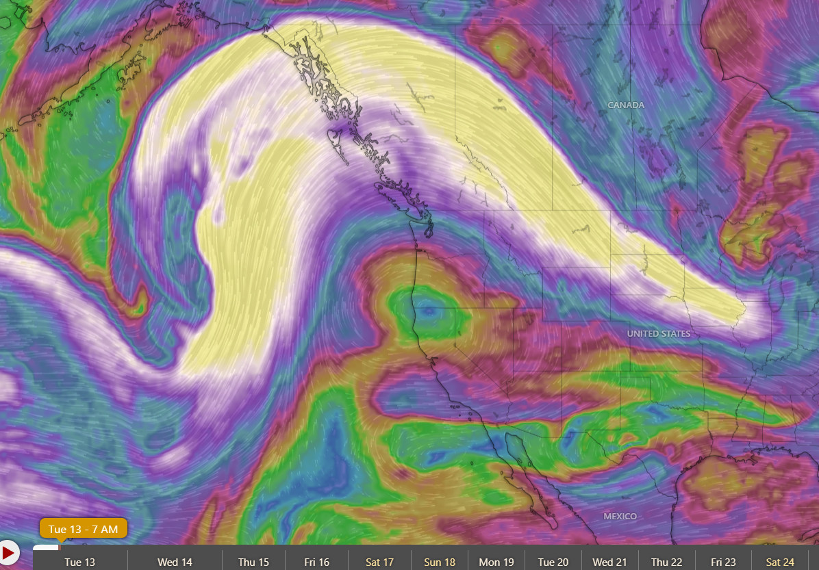
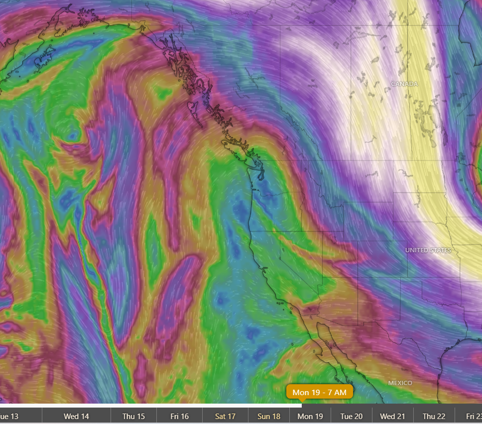
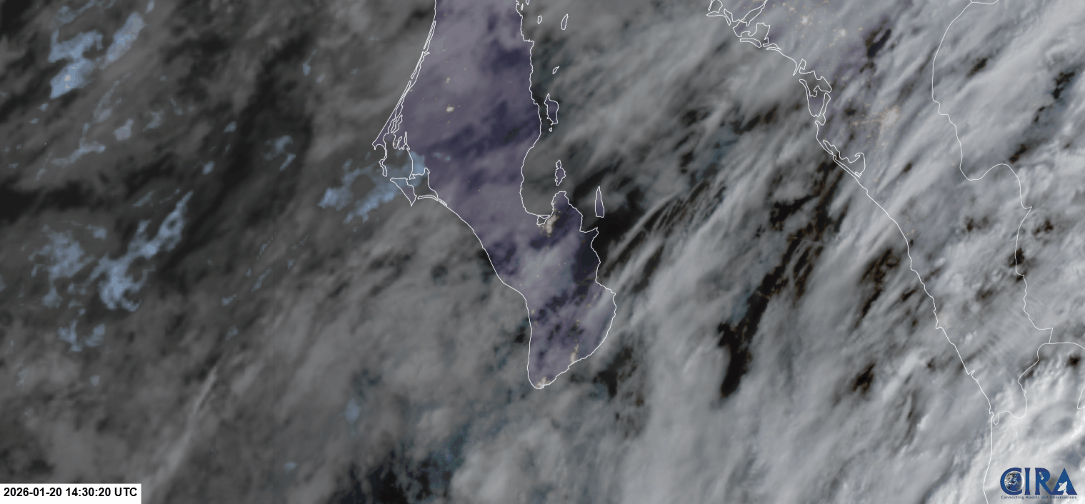
¡Buenos dias! The gauge at the campground yesterday showed 10-minute sustained winds peaked at 20 mph from 2-3 pm as a perfectly timed area of clearing over the plains to our south and west sent our local thermal into overdrive (see satellite loops below). An Oceansat satellite pass shortly before midnight measured NW winds of 10 knots over the Sea of Cortez near Cerralvo, and all of the latest model forecasts show ample NNW to N background flow today. Infrared satellite loops early this morning showed just a few remnant clouds in our region, and all of the latest forecast models indicate a sunny day ahead, so our local thermal should be hitting on all cylinders this afternoon. Our 21 day windy streak will likely come to an end on Thursday, as a trough of low pressure over southern California will move slowly eastward and cause our surface pressure gradient to weaken. At this point it looks like the background flow over our area on Thursday will fall just below what is usually needed to trigger our local wind machine. As the low to our north creeps slowly eastward on Friday and Saturday, our winds will remain light and we will lots of cloud cover and even some showers on Saturday. The low will accelerate eastward on Sunday and allow surface high pressure to rapidly build into the Baja Peninsula, bringing solid north flow and sunny skies back to our region. The surface high centered over the interior west of the U.S. is then forecast to remain essentially stationary through much of next week, with another long streak of windy days looking likely.
- Today…Sunny. North wind 16-20 mph.
- Thursday…Mostly sunny. North wind 12-14 mph.
- Friday…Mostly cloudy with a few showers possible late. Northeast wind 8-10 mph.
- Saturday…Coudy with showers likely. Light and variable wind.
- Sunday…Sunny. North wind 18-22 mph.
- Monday…Sunny. North wind 20-24 mph.
- Tuesday…Sunny. North wind 18-22 mph.