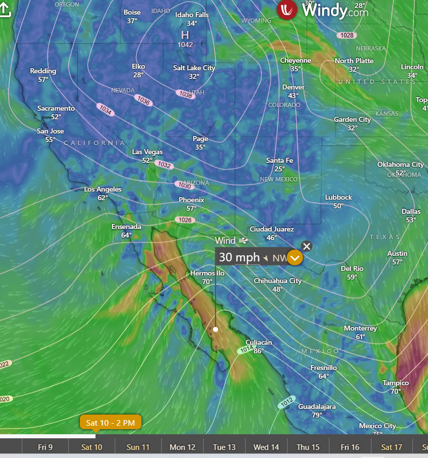
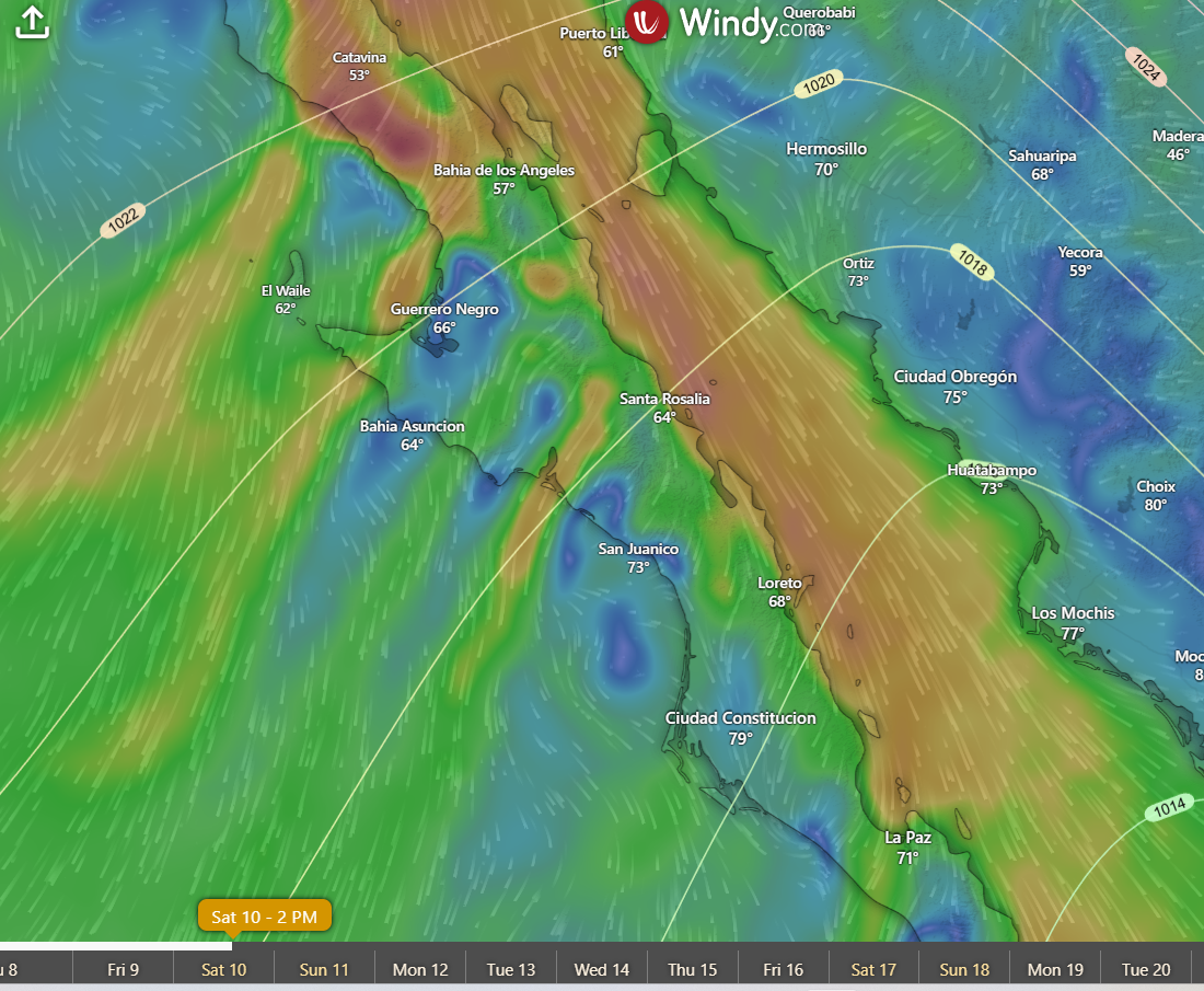
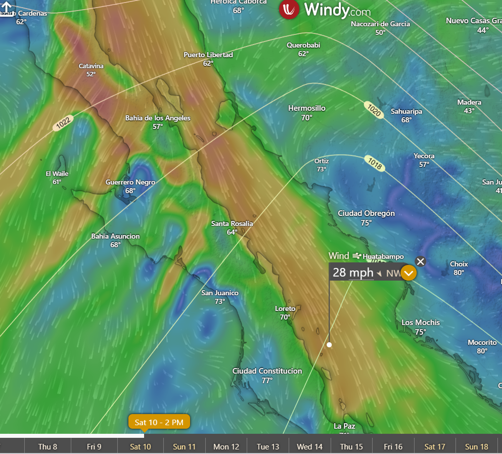
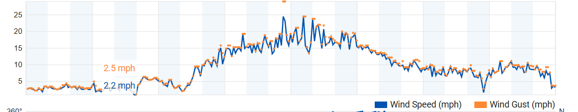
¡Buenos dias! Wind gauges yesterday recorded sustained winds in the low to mid 20s with gusts into the mid 30s as the strongest norte so far this season arrived. As is typical of the bigger nortes, strong wind gusts continued overnight even with a significant west component, with area gauges recording occasional gusts from the upper 20s into the mid 30s early this morning. A Haiyang satellite pass last evening measured 25 knot winds just east of Cerralvo, with solid 30 knot winds over the southern Sea of Cortez from just north of Cerralvo north-northwestward for several hundred miles (see nerd note below). Nearly all of the latest model forecasts continue to be in excellent agreement that the strong surface high centered near Salt Lake City this morning will remain locked in place through at least Thursday, and although norte conditions will likely ease tomorrow as the high weakens a bit, solid NNW background flow will very likely continue through at least Thursday. While there are some differences in the extended range forecasts, most are showing that we will continue to see ample north background flow through next weekend and possibly into the following week. There may be some thin, high clouds from time to time over the next week, especially on Wednesday and Thursday, but at this point it looks like there will be enough sunshine each day to trigger our local thermal.
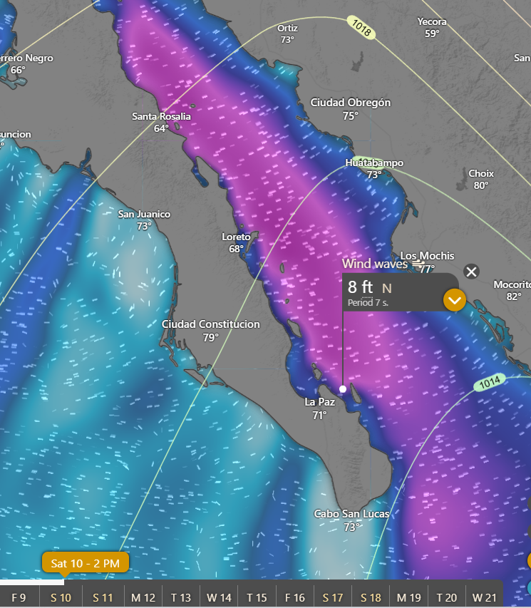
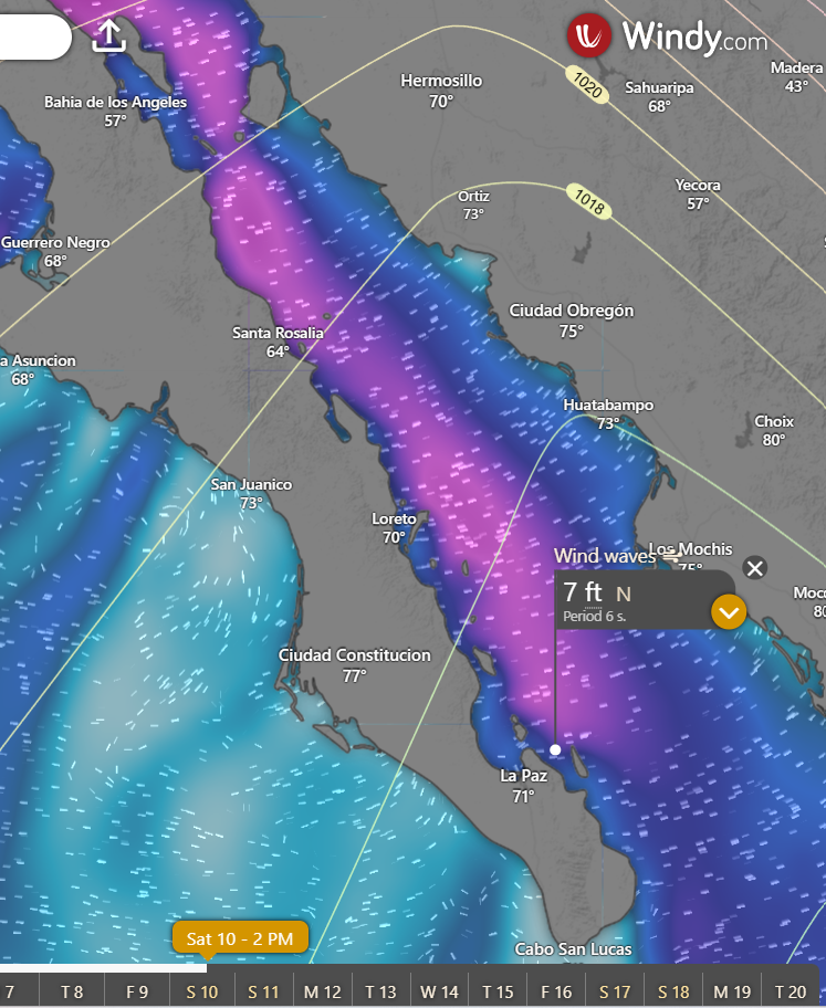
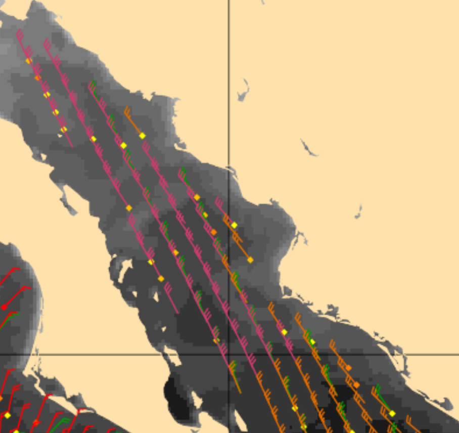
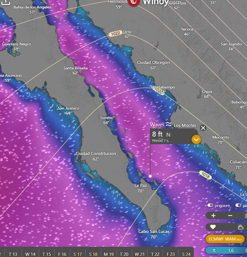
Nerd Note: As noted above one of the polar-orbiting satellites recorded the current norte in all its glory last evening. These satellites use directed microwave and radar pulses to determine wind speeds to within about 5 mph. The graphic below shows 25 knot winds near Cerralvo, and 30 knot winds (3 barbs) from just north of Cerralvo to a point in the east-central Sea of Cortez…a distance of over 350 miles. This will likely generate large swell directed into La Ventana Bay today, and model forecasts are showing wave heights entering the northern bay of 8 feet. We don’t have any buoys nearby to measure wave heights, so I’d like to hear your observations. Of course please be safe entering and exiting the water today…there will likely be a big shore break at times.
- Today…Sunny. North wind 22-26 mph and gusty.
- Sunday…Sunny. North wind 20-24 mph.
- Monday…Sunny. North wind 20-24 mph.
- Tuesday…Sunny. North wind 20-24 mph.
- Wednesday…Mostly sunny. North wind 18-22 mph.
- Thursday…Mostly sunny. North wind 18-22 mph.
- Friday…Sunny. North wind 16-20 mph.