¡Buenos dias! NNW winds of 10-15 knots were measured near Cerralvo by a couple of evening satellite passes, and all of the latest model forecasts show solid NNW background flow will continue today. A few morning high clouds should move off to the east, with a significant thermal boost expected this afternoon. Models are in excellent agreement that high pressure over the western U.S. will remain locked in place through the upcoming weekend and likely through next week as well, with ample north background flow continuing over our region (see nerd note below). Some high clouds may partially dampen our local thermal on Sunday and Monday, but otherwise we should see substantial thermal boosts each afternoon.
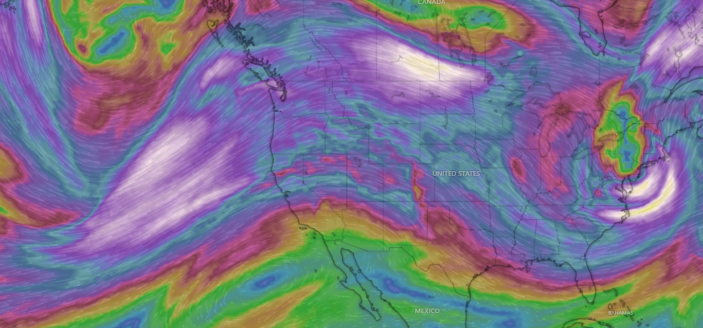
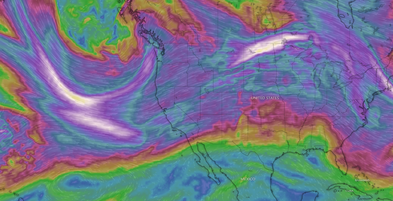
Nerd Note: A weather phenomenon known as a blocking pattern has been present over parts of the western U.S. for the past several weeks, and this pattern is expected to continue through at least next week. A large ridge of high pressure in the middle and upper levels of the atmosphere over California has deflected storm systems from the Pacific northward into northern Oregon and Washington with flooding rains there, however to the south, little or no precipitation has occured since the middle of November. The first graphic below shows the wind pattern this morning at 500 millibars, which is around 20,000 feet above sea level. Note the large ridge over California and the deep trough over the eastern U.S. By Friday, December 19, the ridge is still in place (second graphic), but extended range model forecasts are showing the possibility of a pattern change by Christmas week (third graphic), with rain and snow possibly returning to California.

- Today…Mostly sunny. North wind 18-22 mph.
- Thursday…Sunny. North wind 16-20 mph.
- Friday…Sunny. North wind 16-20 mph.
- Saturday…Sunny. North wind 16-20 mph.
- Sunday…Mostly sunny. North wind 16-18 mph.
- Monday…Mostly sunny. North wind 16-18 mph.
- Tuesday…Sunny. North wind 18-22 mph.