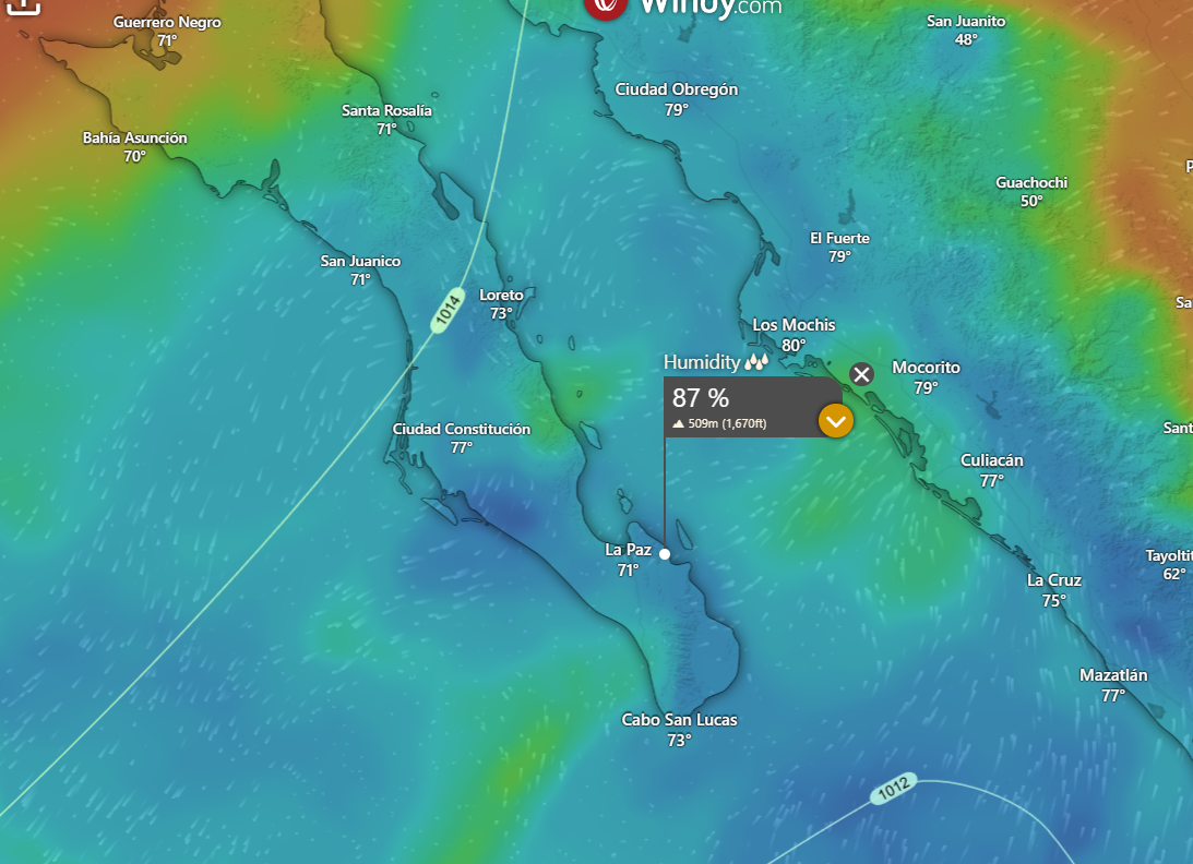
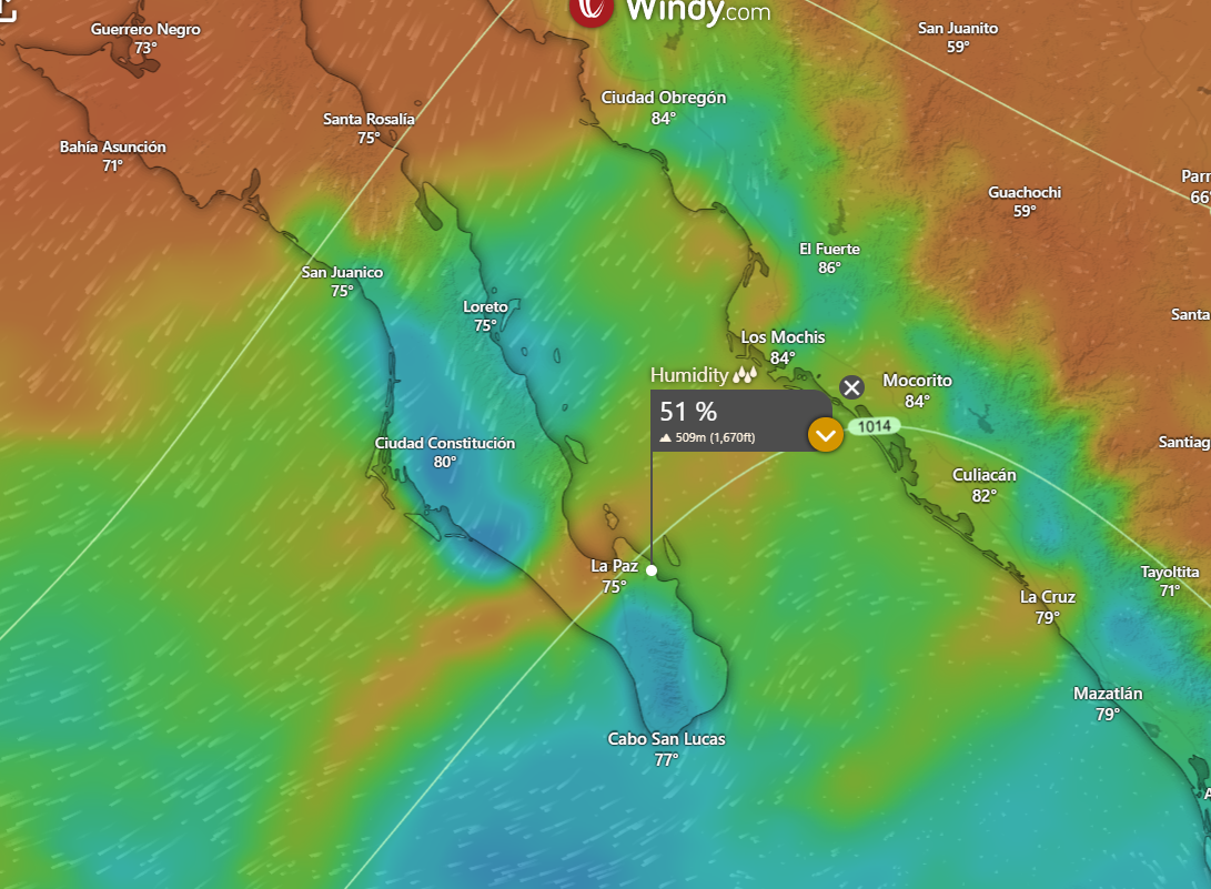
¡Buenos dias! Local rain gauges showed storm total rainfall over the past 2 days was right around 1 inch, and the latest batch of model forecasts show that while we may see some light showers or sprinkles today, the bulk of the rain is over. Satellite passes measured north winds of around 10 knots near Cerralvo late last evening, and models show similar background flow will continue today. While this would normally be more than enough to trigger our local wind machine, satellite images show abundant low-level clouds remain over our region, and model forecasts indicate that significant low clouds are likely to last through this afternoon…effectively putting a damper on our local thermal. Of course if we see (unexpected) significant breaks in the cloud cover this afternoon, we could see rideable winds so best to be ready just in case. This rare long stretch of cloudy, rainy, no wind days will finally come to an end on Sunday as surface high pressure builds into the interior western U.S. and drier air filters into BCS. Model forecasts are in good agreement that not only will the background north flow increase significantly on Sunday, but the atmosphere will dry out as well, leaving mostly sunny skies. The graphics below show the relative humidity at around 5000 ft this aftermoon, then much drier air for Sunday. Model forecasts are in good agreement that the surface high to our north will then remain parked there for much of the remainer of the week, and with abundant sunshine expected each day, we should see a great stretch of windy days ahead.
- Today…Mostly cloudy with a few showers possible. North wind 10-12 mph.
- Sunday…Mostly sunny. North wind 18-22 mph.
- Monday…Sunny. North wind 20-24 mph.
- Tuesday…Mostly sunny. North wind 18-22 mph.
- Wednesday…Sunny. North wind 18-22 mph.
- Thursday…Sunny. North wind 16-20 mph.
- Friday…Sunny. North wind 16-20 mph.