¡Buenos dias! Mostly sunny skies gave us a bonus day yesterday (see nerd note below) and all of the latest numerical model forecasts show abundant sunshine will continue today. Surface high pressure centered over northern Utah this morning will send solid north background flow into BCS, and a sunny afternoon will bring us an added thermal boost. The remainder of the forecast remains unchanged as the surface high far to our north remains parked over the western U.S. and N to NNW background winds continue for our region. A few thin, high clouds are still likely on Tuesday, but otherwise sunny skies are expected through Friday. At this point it lookds like the surface high will weaken on Saturday, and with increasing high clouds we should see winds diminish here.
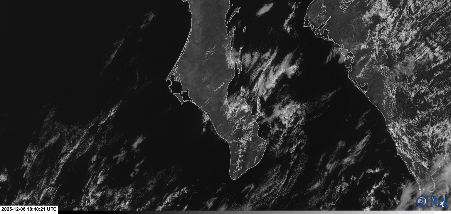
Nerd Note: The substantial cloud cover I thought would likely form yesterday afternoon luckily didn't materialize, and with sunny skies for most of the day we saw our local thermal quickly kick in. A visible satellite loop from late morning through mid-afternoon (see below) showed the plains to our south and southwest remained clear while abundant cloud cover nearly surrounded that area. While the satellite loop does show abundant low-level moisture, it took just a bit of lift from higher terrain surrounding the plains to form clouds as the north background flow moved over the region. Closer to La Ventana, you can see lots of clouds locked-in over the Cacachilas Mountains to our northwest, and also a line of cumulus clouds formed by the higher terrain on Cerralvo streaming southward to just west of the lighthouse.
- Today…Mostly sunny. North wind 18-22 mph.
- Monday…Sunny. North wind 20-24 mph.
- Tuesday…Mostly sunny. North wind 18-22 mph.
- Wednesday…Sunny. North wind 18-22 mph.
- Thursday…Sunny. North wind 16-20 mph.
- Friday…Sunny. North wind 16-20 mph.
- Saturday…Partly sunny. North wind 14-16 mph.