¡Buenos dias! An Oceansat satellite pass just before midnight measured 10-15 knot NNW winds over the Sea of Cortez near Cerralvo, and the latest batch of model forecasts show the background flow over our region will increase today. Infrared satellite loops early this morning showed clear skies over BCS, and the models are in good agreement that we will see lots of sunshine today to help drive our local thermal. Surface low pressure spinning just off the California coast this morning is forecast to drop southward today then move inland over the northern Baja Peninsula on Wednesday. As this happens, the ridge of high pressure to our north will be pushed southward closer to us, and as a result, the new model runs are showing a significant westerly component to the winds tomorrow. It’ll likely be a battle between the dreaded westerlies and our local thermal, but if we see enough sun tomorrow afternoon, the thermal could be just strong enough to pull the winds onshore. Thursday will likely see ample north background flow returning to BCS, but we may see thicker cloud cover as well that could at least partially dampen our thermal. For those that have been waiting all season for a big norte, you are in luck (see nerd note below) as models are in excellent agreement that a strong surface high pressure system will build into the interior west of the U.S. on Friday, then remain nearly stationary through at least Sunday. The norte may begin to slowly subside on Sunday, but with the surface high locked in place, we’ll likely see solid north flow continuing into next week.
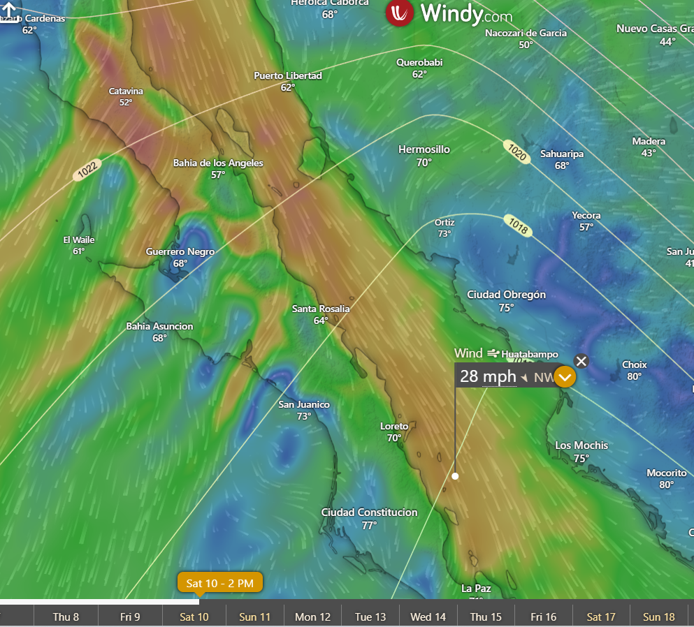
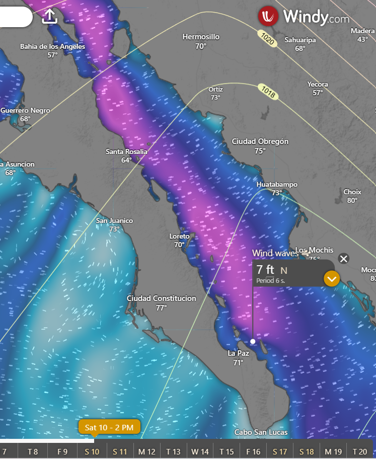
Nerd Note: Several of the global models not only forecast atmospheric conditions, but also forecast ocean wave heights. They do this by complex, physics-based calculations, but 3 of the main ingredients are wind speed, fetch (the distance over which the wind blows), and the duration of the wind. Model forecasts for Saturday show very strong winds over the length of the Sea of Cortez, with a trajectory pointing right at us (see graphic below). The second graphic shows the ECMWF model forecast for wind waves, showing 7 foot swell coming into the north end of La Ventana Bay on Saturday afternoon.
- Today…Sunny. North wind 18-22 mph.
- Wednesday…Mostly sunny. North/northwest wind 16-18 mph.
- Thursday…Partly sunny. North wind 16-18 mph.
- Friday…Sunny. North wind 22-26 mph.
- Saturday…Sunny. North wind 22-26 mph.
- Sunday…Sunny. North wind 20-24 mph.
- Monday…Sunny. North wind 18-22 mph.