¡Buenos dias! One of the polar-orbiting satellites measured 15 knot NNW winds just east of Cerralvo around midnight as surface high pressure centered over northern Utah maintained a farily tight surface pressure gradient over BCS. The wild card today will be the thickness of high cloud cover, as all of the most recent model forecasts show a band of high clouds to our west will move over BCS by mid morning and may significantly dampen our local thermal. Model forecasts are in good agreement that the surface high will move into the 4-corners area of the U.S. on Thursday then begin to weaken on Friday, with north background flow continuing over our region. Although models show some high clouds will stream in from the southwest Thursday into Friday, there may be some thin spots in the cloud cover and we could see just enough filtered sunshine to at least partially trigger our thermal. The background flow over BCS will likely become light on Saturday as the surface pressure gradient becomes very weak. Surface low pressure is then forecast to move from northern Arizona Sunday eastward into west Texas on Monday, and this will continue our streak of down days. A weak pulse of north flow may reach us on Tuesday, but model forecasts are in good agreement that we will still see abundant high clouds so our local thermal may be relatively anemic.
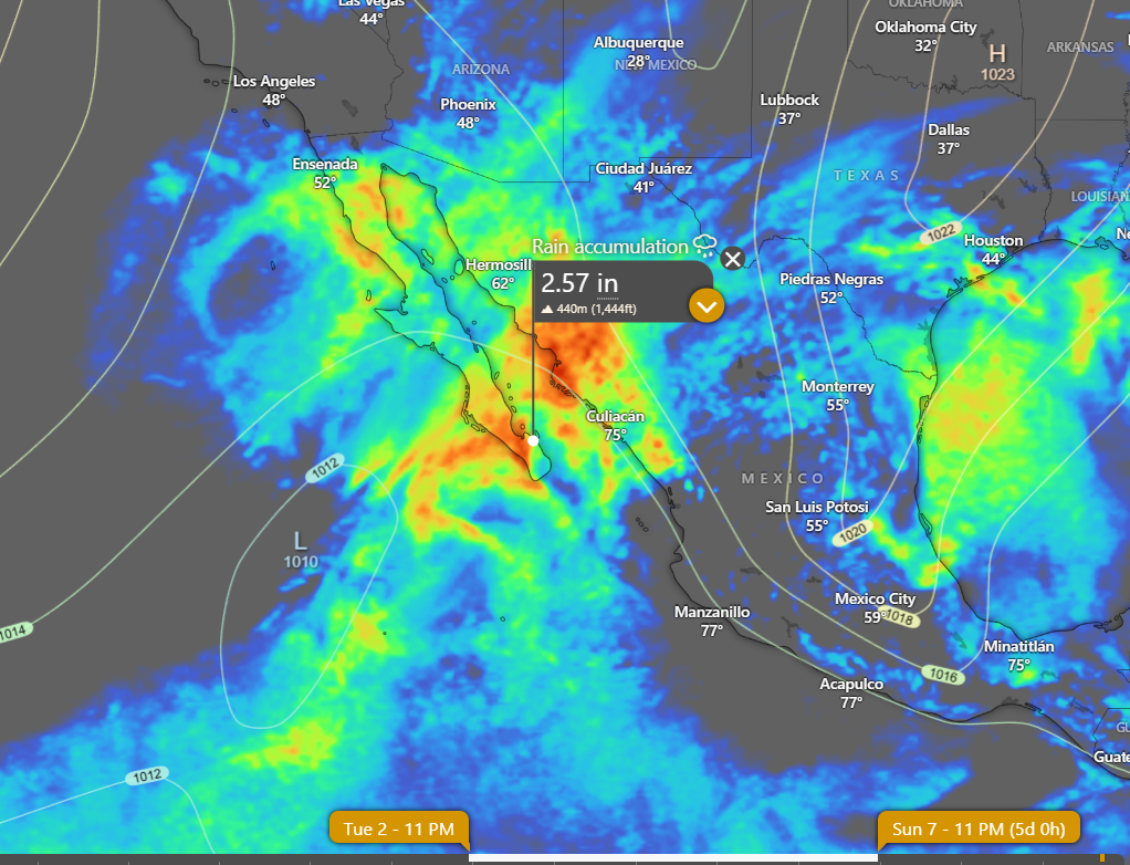
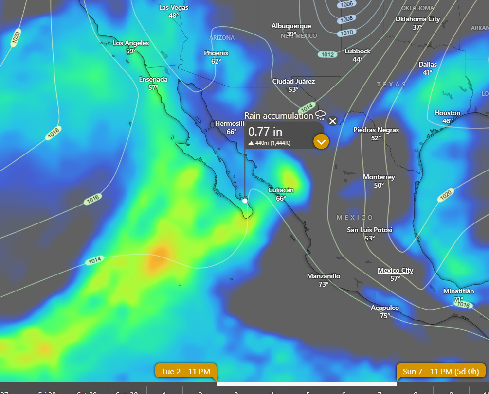
Nerd Note: Over the past week or so the long-range global models have been hinting at a possible significant rain event beginning Wednesday of next week and continuing through the following weekend. Model forecasts are now in fairly good agreement that a mid to upper-level low pressure system will track from west to east across the Baja Peninsula on Wednesday. Circulation around this system may drag a weak surface low from deep in the tropics to our southwest…northeastward into BCS on Wednesday with widespread showers and maybe even a few thunderstorms. Very unsettled weather is then forecast to continue Thursday possibly into the following Sunday as a very strong mid and upper-level storm system dives southward from California into BCS and then moves very slowly eastward…producing an extended period of showers and isolated thunderstorms. Below are 2 graphs showing model forecasts of cumulative rainfall from Wednesday, December 3 through Sunday, December 7. In addition to the rain, models are in good agreement that we will also see very light winds during that period.
- Today…Increasing high clouds. North wind 16-18 mph.
- Thursday…Mostly sunny. North wind 16-20 mph.
- Friday…Mostly sunny. North wind 16-18 mph.
- Saturday…Mostly sunny. Northeast wind 8-10 mph.
- Sunday…Partly sunny. Light and variable wind.
- Monday…Partly sunny. Light and variable wind.
- Tuesday…Partly sunny. North wind 14-16 mph.